Örencik geodata
Örencik (Kütahya) is a seat of a third-order administrative division; located in Turkey in Europe/Istanbul (GMT+3) time zone. In our database, there are 1323 cities with bigger population. Compared to other cities in Turkey, 58.4% of cities are located further ↓South; 79.1% of cities are located further →East and 70.6% of cities have lower elevation than Örencik. Note1


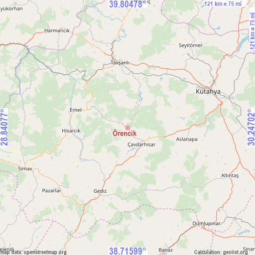
Örencik GPS coordinates[2]
39° 15' 45" North, 29° 32' 38.004" East
| Map corner | latitude | longitude |
|---|---|---|
| Upper-left | 39.80478°, | 28.84077° |
| Center: | 39.2625°, | 29.54389° |
| Lower-right: | 38.71599°, | 30.24702° |
| Map W x H: | 121.1×121.1 km | = 75.2×75.2mi |
| max Lat: | 42.02683° ⇑41.6% North |
| Örencik: | 39.2625° |
| min Lat: | ⇓58.4% South 35.9025° |
| min Long | Örencik | max Long |
| 25.90902° | 29.54389° | 44.60099° |
| W 20.9%⇐ | ⇒79.1% E |
Elevation
Elevation of Örencik is 1036 m = 3399 ft, and this is 318.6 m = 1045 ft above average elevation for this country.
| Max E: |
2682 m = 8799 ft | 29.4% |
| Örencik | 1036 m 3399 ft | |
| Avg. | 717.4 m = 2354 ft | |
Min E: |
0 m = 0 ft | 70.6% |
See also: Turkey elevation on elevation.city.
Geographical zone
Örencik is located in North temperate zone (between Tropic of Cancer and the Arctic Circle). Distance of this Northern Tropic circle is 1759.7 km =1093.4 mi to South.| Distance of | km | miles | from Örencik |
|---|---|---|---|
| North Pole | 5641.5 | 3505.5 | to North |
| Arctic Circle | 3035.6 | 1886.2 | to North |
| Tropic Cancer | 1759.7 | 1093.4 | to South |
| Equator | 4365.6 | 2712.7 | to South |


Nearby cities:
15 places around Örencik: (largest is in red/bold)
• Altıntaş
53.7 km =33.4 mi,  114°
114°
• Aslanapa
28.6 km =17.8 mi,  100°
100°
• Dağardı
50.7 km =31.5 mi,  291°
291°
• Dumlupınar
58.8 km =36.5 mi,  140°
140°
• Emet
26.1 km =16.2 mi, 290°
• Gediz
32.6 km =20.3 mi,  203°
203°
• Harmancık
56.8 km =35.3 mi,  324°
324°
• Hisarcık
27 km =16.8 mi,  267°
267°
• Köprüören
33.2 km =20.6 mi,  34°
34°
• Kütahya
41.8 km =26 mi,  64°
64°
• Pazarlar
46.7 km =29 mi,  230°
230°
• Simav
52.5 km =32.6 mi,  248°
248°
• Tavşanlı
31.4 km =19.5 mi,  352°
352°
• Çavdarhisar
10 km =6.2 mi, 139°
• Şaphane
38.1 km =23.7 mi, 226°
Sources, notices
• [Note1] Compared only with cities in Turkey existing in our database
• [Src1] Map data: © OpenStreetMap contributors (CC-BY-SA)
• [Src2] Other city data from geonames.org with taken over terms of usage.
• [Src3] Geographical zone / Annual Mean Temperature by Robert A. Rohde @ Wikipedia
