Yarbasan geodata
Yarbasan (Manisa) is a seat of a third-order administrative division; located in Turkey in Europe/Istanbul (GMT+3) time zone. In our database, there are 1323 cities with bigger population. Compared to other cities in Turkey, 54.3% of cities are located further ↓South; 85.5% of cities are located further →East and 62.1% of cities have lower elevation than Yarbasan. Note1


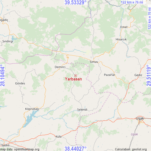
Yarbasan GPS coordinates[2]
38° 59' 20.004" North, 28° 48' 29.016" East
| Map corner | latitude | longitude |
|---|---|---|
| Upper-left | 39.53329°, | 28.10494° |
| Center: | 38.98889°, | 28.80806° |
| Lower-right: | 38.44027°, | 29.51119° |
| Map W x H: | 121.5×121.5 km | = 75.5×75.5mi |
| max Lat: | 42.02683° ⇑45.7% North |
| Yarbasan: | 38.98889° |
| min Lat: | ⇓54.3% South 35.9025° |
| min Long | Yarbasan | max Long |
| 25.90902° | 28.80806° | 44.60099° |
| W 14.5%⇐ | ⇒85.5% E |
Elevation
Elevation of Yarbasan is 914 m = 2999 ft, and this is 196.6 m = 645 ft above average elevation for this country.
| Max E: |
2682 m = 8799 ft | 37.9% |
| Yarbasan | 914 m 2999 ft | |
| Avg. | 717.4 m = 2354 ft | |
Min E: |
0 m = 0 ft | 62.1% |
See also: Turkey elevation on elevation.city.
Geographical zone
Yarbasan is located in North temperate zone (between Tropic of Cancer and the Arctic Circle). Distance of this Northern Tropic circle is 1729.2 km =1074.5 mi to South.| Distance of | km | miles | from Yarbasan |
|---|---|---|---|
| North Pole | 5671.9 | 3524.4 | to North |
| Arctic Circle | 3066 | 1905.1 | to North |
| Tropic Cancer | 1729.2 | 1074.5 | to South |
| Equator | 4335.2 | 2693.8 | to South |


Nearby cities:
15 places around Yarbasan: (largest is in red/bold)
• Borlu
39.5 km =24.5 mi,  228°
228°
• Dağardı
51.7 km =32.1 mi,  18°
18°
• Demirci
14.4 km =8.9 mi,  296°
296°
• Düvertepe
42.1 km =26.2 mi,  311°
311°
• Gediz
50.4 km =31.3 mi,  89°
89°
• Gördes
45.3 km =28.1 mi,  262°
262°
• Güre
48.8 km =30.3 mi,  140°
140°
• Hisarcık
46.7 km =29 mi,  51°
51°
• Kula
51 km =31.7 mi,  195°
195°
• Köprübaşı
43.9 km =27.3 mi, 232°
• Menye
53.7 km =33.4 mi,  211°
211°
• Pazarlar
27.5 km =17.1 mi, 88°
• Selendi
27.7 km =17.2 mi,  169°
169°
• Simav
18.3 km =11.4 mi, 52°
• Şaphane
36 km =22.4 mi,  83°
83°
Sources, notices
• [Note1] Compared only with cities in Turkey existing in our database
• [Src1] Map data: © OpenStreetMap contributors (CC-BY-SA)
• [Src2] Other city data from geonames.org with taken over terms of usage.
• [Src3] Geographical zone / Annual Mean Temperature by Robert A. Rohde @ Wikipedia
