Ovacık geodata
Ovacık (Tunceli) is a seat of a second-order administrative division; located in Turkey in Europe/Istanbul (GMT+3) time zone. In our database, there are 1323 cities with bigger population. Compared to other cities in Turkey, 59.5% of cities are located further ↓South; 69.3% of cities are located further ←West and 82% of cities have lower elevation than Ovacık. Note1


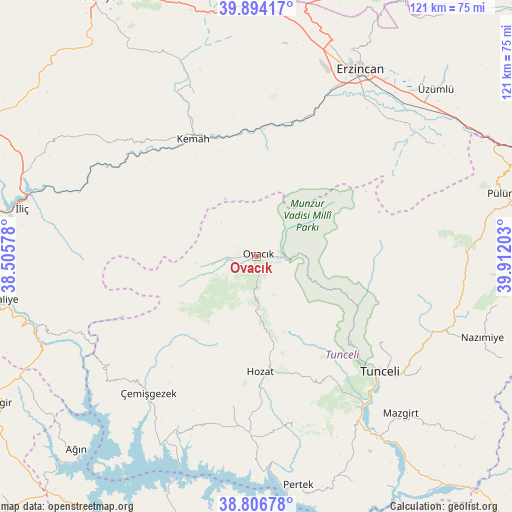
Ovacık GPS coordinates[2]
39° 21' 9.324" North, 39° 12' 32.04" East
| Map corner | latitude | longitude |
|---|---|---|
| Upper-left | 39.89417°, | 38.50578° |
| Center: | 39.35259°, | 39.2089° |
| Lower-right: | 38.80678°, | 39.91203° |
| Map W x H: | 120.9×120.9 km | = 75.1×75.1mi |
| max Lat: | 42.02683° ⇑40.5% North |
| Ovacık: | 39.35259° |
| min Lat: | ⇓59.5% South 35.9025° |
| min Long | Ovacık | max Long |
| 25.90902° | 39.2089° | 44.60099° |
| W 69.3%⇐ | ⇒30.7% E |
Elevation
Elevation of Ovacık is 1233 m = 4045 ft, and this is 515.6 m = 1692 ft above average elevation for this country.
| Max E: |
2682 m = 8799 ft | 18% |
| Ovacık | 1233 m 4045 ft | |
| Avg. | 717.4 m = 2354 ft | |
Min E: |
0 m = 0 ft | 82% |
See also: Turkey elevation on elevation.city.
Geographical zone
Ovacık is located in North temperate zone (between Tropic of Cancer and the Arctic Circle). Distance of this Northern Tropic circle is 1769.7 km =1099.6 mi to South.| Distance of | km | miles | from Ovacık |
|---|---|---|---|
| North Pole | 5631.5 | 3499.3 | to North |
| Arctic Circle | 3025.6 | 1880 | to North |
| Tropic Cancer | 1769.7 | 1099.6 | to South |
| Equator | 4375.6 | 2718.9 | to South |


Nearby cities:
15 places around Ovacık: (largest is in red/bold)
• Alpköy
29.1 km =18.1 mi,  356°
356°
• Bozoğlak
46.1 km =28.6 mi,  310°
310°
• Dere
41.8 km =26 mi,  169°
169°
• Doğanbeyli
40.9 km =25.4 mi,  338°
338°
• Gedikler
46.1 km =28.6 mi,  229°
229°
• Hozat
28.1 km =17.5 mi,  180°
180°
• Karaoğlan
14 km =8.7 mi, 180°
• Kemah
31.4 km =19.5 mi,  329°
329°
• Oğuz
32.7 km =20.3 mi,  301°
301°
• Sütlüce
35.8 km =22.2 mi,  126°
126°
• Tunceli
40.3 km =25 mi, 134°
• Yeşilyazı
11.2 km =7 mi,  259°
259°
• Çağlarca
35.6 km =22.1 mi,  189°
189°
• Çemişgezek
42 km =26.1 mi,  218°
218°
• Çiçekli
37.6 km =23.4 mi,  151°
151°
Sources, notices
• [Note1] Compared only with cities in Turkey existing in our database
• [Src1] Map data: © OpenStreetMap contributors (CC-BY-SA)
• [Src2] Other city data from geonames.org with taken over terms of usage.
• [Src3] Geographical zone / Annual Mean Temperature by Robert A. Rohde @ Wikipedia
