Oğuz geodata
Oğuz (Erzincan) is a seat of a third-order administrative division; located in Turkey in Europe/Istanbul (GMT+3) time zone. In our database, there are 1323 cities with bigger population. Compared to other cities in Turkey, 61.4% of cities are located further ↓South; 66.6% of cities are located further ←West and 84.3% of cities have lower elevation than Oğuz. Note1


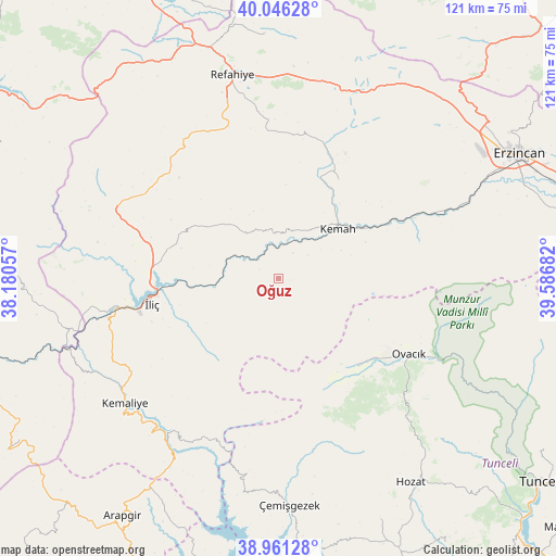
Oğuz GPS coordinates[2]
39° 30' 21.24" North, 38° 53' 1.284" East
| Map corner | latitude | longitude |
|---|---|---|
| Upper-left | 40.04628°, | 38.18057° |
| Center: | 39.5059°, | 38.88369° |
| Lower-right: | 38.96128°, | 39.58682° |
| Map W x H: | 120.6×120.6 km | = 74.9×74.9mi |
| max Lat: | 42.02683° ⇑38.6% North |
| Oğuz: | 39.5059° |
| min Lat: | ⇓61.4% South 35.9025° |
| min Long | Oğuz | max Long |
| 25.90902° | 38.88369° | 44.60099° |
| W 66.6%⇐ | ⇒33.4% E |
Elevation
Elevation of Oğuz is 1294 m = 4245 ft, and this is 576.6 m = 1892 ft above average elevation for this country.
| Max E: |
2682 m = 8799 ft | 15.7% |
| Oğuz | 1294 m 4245 ft | |
| Avg. | 717.4 m = 2354 ft | |
Min E: |
0 m = 0 ft | 84.3% |
See also: Turkey elevation on elevation.city.
Geographical zone
Oğuz is located in North temperate zone (between Tropic of Cancer and the Arctic Circle). Distance of this Northern Tropic circle is 1786.7 km =1110.2 mi to South.| Distance of | km | miles | from Oğuz |
|---|---|---|---|
| North Pole | 5614.4 | 3488.6 | to North |
| Arctic Circle | 3008.5 | 1869.4 | to North |
| Tropic Cancer | 1786.7 | 1110.2 | to South |
| Equator | 4392.6 | 2729.4 | to South |


Nearby cities:
15 places around Oğuz: (largest is in red/bold)
• Alpköy
28.6 km =17.8 mi,  65°
65°
• Armutlu
39.9 km =24.8 mi,  281°
281°
• Başpınar
39 km =24.2 mi,  205°
205°
• Bozoğlak
14.8 km =9.2 mi,  331°
331°
• Cengerli
32.2 km =20 mi,  354°
354°
• Doğanbeyli
24.7 km =15.3 mi,  31°
31°
• Gümüşakar
36.7 km =22.8 mi, 330°
• Karaoğlan
41.8 km =26 mi,  138°
138°
• Kemah
15.6 km =9.7 mi,  50°
50°
• Kemaliye
42.8 km =26.6 mi,  230°
230°
• Kuruçay
38.1 km =23.7 mi,  293°
293°
• Ovacık
32.7 km =20.3 mi,  121°
121°
• Refahiye
44.2 km =27.5 mi, 346°
• Yeşilyazı
25.5 km =15.8 mi, 138°
• İliç
28.6 km =17.8 mi,  257°
257°
Sources, notices
• [Note1] Compared only with cities in Turkey existing in our database
• [Src1] Map data: © OpenStreetMap contributors (CC-BY-SA)
• [Src2] Other city data from geonames.org with taken over terms of usage.
• [Src3] Geographical zone / Annual Mean Temperature by Robert A. Rohde @ Wikipedia
