Karaoğlan geodata
Karaoğlan (Tunceli) is a seat of a third-order administrative division; located in Turkey in Europe/Istanbul (GMT+3) time zone. In our database, there are 1323 cities with bigger population. Compared to other cities in Turkey, 57.9% of cities are located further ↓South; 69.3% of cities are located further ←West and 98.5% of cities have lower elevation than Karaoğlan. Note1


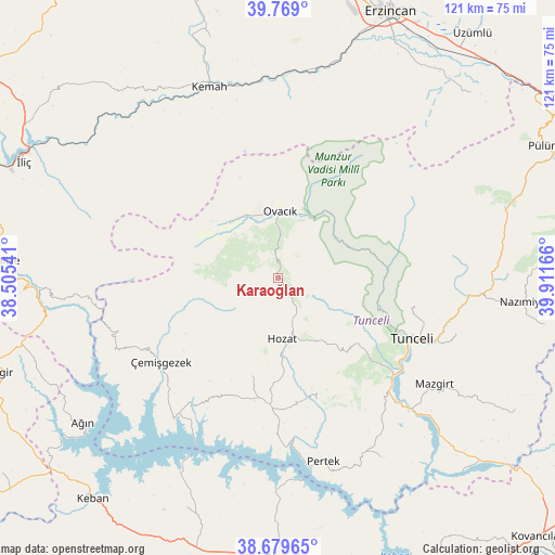
Karaoğlan GPS coordinates[2]
39° 13' 35.184" North, 39° 12' 30.708" East
| Map corner | latitude | longitude |
|---|---|---|
| Upper-left | 39.769°, | 38.50541° |
| Center: | 39.22644°, | 39.20853° |
| Lower-right: | 38.67965°, | 39.91166° |
| Map W x H: | 121.1×121.1 km | = 75.2×75.2mi |
| max Lat: | 42.02683° ⇑42.1% North |
| Karaoğlan: | 39.22644° |
| min Lat: | ⇓57.9% South 35.9025° |
| min Long | Karaoğlan | max Long |
| 25.90902° | 39.20853° | 44.60099° |
| W 69.3%⇐ | ⇒30.7% E |
Elevation
Elevation of Karaoğlan is 1915 m = 6283 ft, and this is 1197.6 m = 3929 ft above average elevation for this country.
| Max E: |
2682 m = 8799 ft | 1.5% |
| Karaoğlan | 1915 m 6283 ft | |
| Avg. | 717.4 m = 2354 ft | |
Min E: |
0 m = 0 ft | 98.5% |
See also: Turkey elevation on elevation.city.
Geographical zone
Karaoğlan is located in North temperate zone (between Tropic of Cancer and the Arctic Circle). Distance of this Northern Tropic circle is 1755.7 km =1090.9 mi to South.| Distance of | km | miles | from Karaoğlan |
|---|---|---|---|
| North Pole | 5645.5 | 3507.9 | to North |
| Arctic Circle | 3039.6 | 1888.7 | to North |
| Tropic Cancer | 1755.7 | 1090.9 | to South |
| Equator | 4361.6 | 2710.2 | to South |


Nearby cities:
15 places around Karaoğlan: (largest is in red/bold)
• Akçapınar
38.6 km =24 mi,  216°
216°
• Dere
28.2 km =17.5 mi,  163°
163°
• Gedikler
38.4 km =23.9 mi,  245°
245°
• Hozat
14 km =8.7 mi,  180°
180°
• Kocakoç
40.7 km =25.3 mi,  107°
107°
• Mazgirt
41 km =25.5 mi,  124°
124°
• Ovacık
14 km =8.7 mi,  0°
0°
• Oğuz
41.8 km =26 mi,  318°
318°
• Pertek
41.3 km =25.7 mi,  166°
166°
• Sütlüce
29.8 km =18.5 mi,  103°
103°
• Tunceli
32.2 km =20 mi, 116°
• Yeşilyazı
16.3 km =10.1 mi, 317°
• Çağlarca
21.9 km =13.6 mi,  195°
195°
• Çemişgezek
32.2 km =20 mi,  233°
233°
• Çiçekli
26.2 km =16.3 mi,  136°
136°
Sources, notices
• [Note1] Compared only with cities in Turkey existing in our database
• [Src1] Map data: © OpenStreetMap contributors (CC-BY-SA)
• [Src2] Other city data from geonames.org with taken over terms of usage.
• [Src3] Geographical zone / Annual Mean Temperature by Robert A. Rohde @ Wikipedia
