Malazgirt geodata
Malazgirt (Muş) is a seat of a second-order administrative division; located in Turkey in Europe/Istanbul (GMT+3) time zone. With population of 26,108 people, there are 276 cities with bigger population in this country. Compared to other cities in Turkey, 56.7% of cities are located further ↓South; 94.4% of cities are located further ←West and 91.1% of cities have lower elevation than Malazgirt. Note1


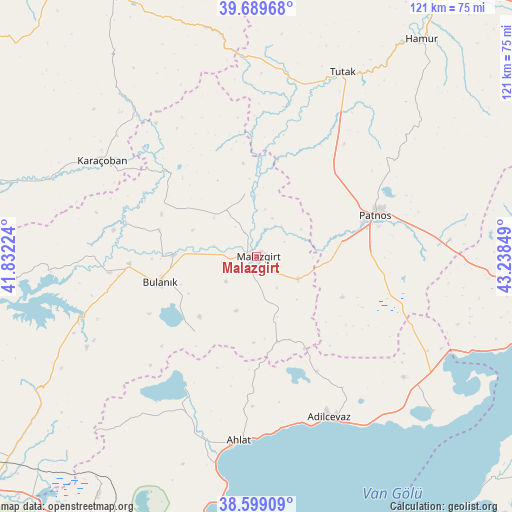
Malazgirt GPS coordinates[2]
39° 8' 47.4" North, 42° 32' 7.296" East
| Map corner | latitude | longitude |
|---|---|---|
| Upper-left | 39.68968°, | 41.83224° |
| Center: | 39.1465°, | 42.53536° |
| Lower-right: | 38.59909°, | 43.23849° |
| Map W x H: | 121.3×121.3 km | = 75.4×75.4mi |
| max Lat: | 42.02683° ⇑43.3% North |
| Malazgirt: | 39.1465° |
| min Lat: | ⇓56.7% South 35.9025° |
| min Long | Malazgirt | max Long |
| 25.90902° | 42.53536° | 44.60099° |
| W 94.4%⇐ | ⇒5.6% E |
Elevation
Elevation of Malazgirt is 1510 m = 4954 ft, and this is 792.6 m = 2600 ft above average elevation for this country.
| Max E: |
2682 m = 8799 ft | 8.9% |
| Malazgirt | 1510 m 4954 ft | |
| Avg. | 717.4 m = 2354 ft | |
Min E: |
0 m = 0 ft | 91.1% |
See also: Turkey elevation on elevation.city.
Geographical zone
Malazgirt is located in North temperate zone (between Tropic of Cancer and the Arctic Circle). Distance of this Northern Tropic circle is 1746.8 km =1085.4 mi to South.| Distance of | km | miles | from Malazgirt |
|---|---|---|---|
| North Pole | 5654.4 | 3513.5 | to North |
| Arctic Circle | 3048.5 | 1894.2 | to North |
| Tropic Cancer | 1746.8 | 1085.4 | to South |
| Equator | 4352.7 | 2704.6 | to South |


Nearby cities:
15 places around Malazgirt: (largest is in red/bold)
• Adilcevaz
42.2 km =26.2 mi,  156°
156°
• Ahlat
44.5 km =27.7 mi,  186°
186°
• Aktuzla
29.7 km =18.5 mi,  313°
313°
• Bulanık
23.7 km =14.7 mi,  253°
253°
• Dedeli
44.9 km =27.9 mi,  86°
86°
• Doğansu
17.1 km =10.6 mi,  95°
95°
• Erentepe
45.1 km =28 mi, 250°
• Karaağıl
38.9 km =24.2 mi,  268°
268°
• Karaçoban
43.5 km =27 mi,  300°
300°
• Nurettin
13.6 km =8.5 mi, 312°
• Nurettin
15.2 km =9.4 mi,  350°
350°
• Ovakışla
41.2 km =25.6 mi,  207°
207°
• Patnos
29.1 km =18.1 mi,  72°
72°
• Sarısu
36.2 km =22.5 mi,  113°
113°
• Tutak
47.9 km =29.8 mi,  24°
24°
Sources, notices
• [Note1] Compared only with cities in Turkey existing in our database
• [Src1] Map data: © OpenStreetMap contributors (CC-BY-SA)
• [Src2] Other city data from geonames.org with taken over terms of usage.
• [Src3] Geographical zone / Annual Mean Temperature by Robert A. Rohde @ Wikipedia
