Hazro geodata
Hazro (Diyarbakır) is a seat of a second-order administrative division; located in Turkey in Europe/Istanbul (GMT+3) time zone. With population of 6,291 people, there are 643 cities with bigger population in this country. Compared to other cities in Turkey, 57.2% of cities are located further ↑North; 79.2% of cities are located further ←West and 66.5% of cities have lower elevation than Hazro. Note1


Hazro GPS coordinates[2]
38° 14' 56.508" North, 40° 46' 16.644" East
| Map corner | latitude | longitude |
|---|---|---|
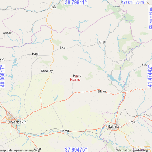
| Upper-left | 38.79911°, | 40.06817° |
| Center: | 38.24903°, | 40.77129° |
| Lower-right: | 37.69475°, | 41.47442° |
| Map W x H: | 122.8×122.8 km | = 76.3×76.3mi |
| max Lat: | 42.02683° ⇑57.2% North |
| Hazro: | 38.24903° |
| min Lat: | ⇓42.8% South 35.9025° |
| min Long | Hazro | max Long |
| 25.90902° | 40.77129° | 44.60099° |
| W 79.2%⇐ | ⇒20.8% E |
Elevation
Elevation of Hazro is 980 m = 3215 ft, and this is 262.6 m = 862 ft above average elevation for this country.
| Max E: |
2682 m = 8799 ft | 33.5% |
| Hazro | 980 m 3215 ft | |
| Avg. | 717.4 m = 2354 ft | |
Min E: |
0 m = 0 ft | 66.5% |
See also: Turkey elevation on elevation.city.
Geographical zone
Hazro is located in North temperate zone (between Tropic of Cancer and the Arctic Circle). Distance of this Northern Tropic circle is 1647 km =1023.4 mi to South.| Distance of | km | miles | from Hazro |
|---|---|---|---|
| North Pole | 5754.2 | 3575.5 | to North |
| Arctic Circle | 3148.3 | 1956.3 | to North |
| Tropic Cancer | 1647 | 1023.4 | to South |
| Equator | 4252.9 | 2642.6 | to South |


Nearby cities:
15 places around Hazro: (largest is in red/bold)
• Akçayır
34.5 km =21.4 mi,  146°
146°
• Altınkum
25.5 km =15.8 mi,  86°
86°
• Ağaçlı
32 km =19.9 mi,  21°
21°
• Bağdere
15.3 km =9.5 mi,  192°
192°
• Hamzalı
35.7 km =22.2 mi,  73°
73°
• Hani
38 km =23.6 mi,  297°
297°
• Kayacık
17.2 km =10.7 mi,  306°
306°
• Kocaköy
24.3 km =15.1 mi,  280°
280°
• Kopuzlu
36.8 km =22.9 mi, 153°
• Kulp
34.4 km =21.4 mi,  36°
36°
• Lice
26 km =16.2 mi,  333°
333°
• Malabadi
39.2 km =24.4 mi,  106°
106°
• Mermer
31.7 km =19.7 mi,  242°
242°
• Silvan
24.2 km =15 mi,  121°
121°
• Yukarı Harım
37.2 km =23.1 mi, 188°
Sources, notices
• [Note1] Compared only with cities in Turkey existing in our database
• [Src1] Map data: © OpenStreetMap contributors (CC-BY-SA)
• [Src2] Other city data from geonames.org with taken over terms of usage.
• [Src3] Geographical zone / Annual Mean Temperature by Robert A. Rohde @ Wikipedia
