Güzeloluk geodata
Güzeloluk (Mersin) is a seat of a third-order administrative division; located in Turkey in Europe/Istanbul (GMT+3) time zone. In our database, there are 1323 cities with bigger population. Compared to other cities in Turkey, 93.4% of cities are located further ↑North; 58.1% of cities are located further →East and 87.7% of cities have lower elevation than Güzeloluk. Note1


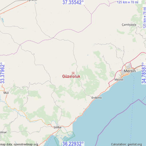
Güzeloluk GPS coordinates[2]
36° 47' 39.984" North, 34° 4' 57.864" East
| Map corner | latitude | longitude |
|---|---|---|
| Upper-left | 37.35542°, | 33.37962° |
| Center: | 36.79444°, | 34.08274° |
| Lower-right: | 36.22932°, | 34.78587° |
| Map W x H: | 125.2×125.2 km | = 77.8×77.8mi |
| max Lat: | 42.02683° ⇑93.4% North |
| Güzeloluk: | 36.79444° |
| min Lat: | ⇓6.6% South 35.9025° |
| min Long | Güzeloluk | max Long |
| 25.90902° | 34.08274° | 44.60099° |
| W 41.9%⇐ | ⇒58.1% E |
Elevation
Elevation of Güzeloluk is 1389 m = 4557 ft, and this is 671.6 m = 2203 ft above average elevation for this country.
| Max E: |
2682 m = 8799 ft | 12.3% |
| Güzeloluk | 1389 m 4557 ft | |
| Avg. | 717.4 m = 2354 ft | |
Min E: |
0 m = 0 ft | 87.7% |
See also: Turkey elevation on elevation.city.
Geographical zone
Güzeloluk is located in North temperate zone (between Tropic of Cancer and the Arctic Circle). Distance of this Northern Tropic circle is 1485.2 km =922.9 mi to South.| Distance of | km | miles | from Güzeloluk |
|---|---|---|---|
| North Pole | 5915.9 | 3676 | to North |
| Arctic Circle | 3310 | 2056.7 | to North |
| Tropic Cancer | 1485.2 | 922.9 | to South |
| Equator | 4091.2 | 2542.2 | to South |


Nearby cities:
15 places around Güzeloluk: (largest is in red/bold)
• Arslanköy
30.9 km =19.2 mi,  36°
36°
• Elvanlı
27.8 km =17.3 mi,  111°
111°
• Erdemli
29.1 km =18.1 mi,  136°
136°
• Gözne
49 km =30.4 mi,  62°
62°
• Kocahasanlı
28.9 km =18 mi, 143°
• Kuzucubelen
32 km =19.9 mi,  80°
80°
• Kırobası
20.8 km =12.9 mi,  247°
247°
• Kızkalesi
37.3 km =23.2 mi,  171°
171°
• Mersin
49.5 km =30.8 mi,  87°
87°
• Mezitli
39.6 km =24.6 mi,  97°
97°
• Mut
59.8 km =37.2 mi, 253°
• Pınarbaşı
26.9 km =16.7 mi, 112°
• Sarıkavak
45.8 km =28.5 mi,  238°
238°
• Silifke
48.2 km =30 mi,  195°
195°
• Taşucu
55.6 km =34.5 mi, 198°
Sources, notices
• [Note1] Compared only with cities in Turkey existing in our database
• [Src1] Map data: © OpenStreetMap contributors (CC-BY-SA)
• [Src2] Other city data from geonames.org with taken over terms of usage.
• [Src3] Geographical zone / Annual Mean Temperature by Robert A. Rohde @ Wikipedia
