Taşucu geodata
Taşucu (Mersin) is a seat of a third-order administrative division; located in Turkey in Europe/Istanbul (GMT+3) time zone. In our database, there are 1323 cities with bigger population. Compared to other cities in Turkey, 97.7% of cities are located further ↑North; 58.7% of cities are located further →East and 99.8% of cities have higher elevation than Taşucu. Note1


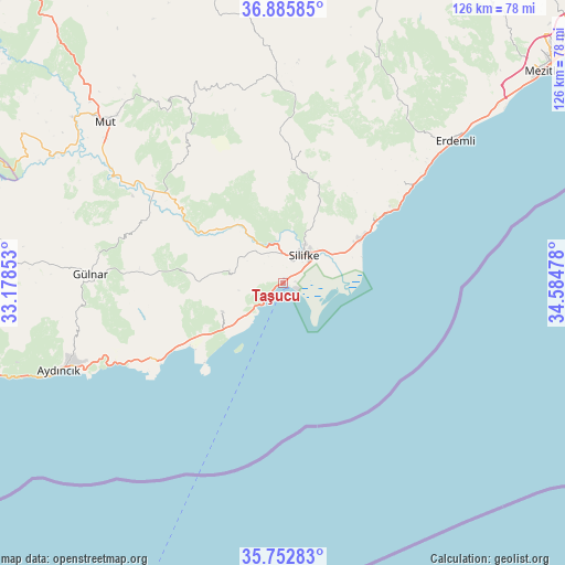
Taşucu GPS coordinates[2]
36° 19' 17.04" North, 33° 52' 53.94" East
| Map corner | latitude | longitude |
|---|---|---|
| Upper-left | 36.88585°, | 33.17853° |
| Center: | 36.3214°, | 33.88165° |
| Lower-right: | 35.75283°, | 34.58478° |
| Map W x H: | 126×126 km | = 78.3×78.3mi |
| max Lat: | 42.02683° ⇑97.7% North |
| Taşucu: | 36.3214° |
| min Lat: | ⇓2.3% South 35.9025° |
| min Long | Taşucu | max Long |
| 25.90902° | 33.88165° | 44.60099° |
| W 41.3%⇐ | ⇒58.7% E |
Elevation
Elevation of Taşucu is 3 m = 10 ft, and this is 714.4 m = 2344 ft below average elevation for this country.
| Max E: |
2682 m = 8799 ft | 99.8% |
| Avg. | 717.4 m = 2354 ft | |
| Taşucu | 3 m = 10 ft | |
Min E: |
0 m = 0 ft | 0.2% |
See also: Turkey elevation on elevation.city.
Geographical zone
Taşucu is located in North temperate zone (between Tropic of Cancer and the Arctic Circle). Distance of this Northern Tropic circle is 1432.6 km =890.2 mi to South.| Distance of | km | miles | from Taşucu |
|---|---|---|---|
| North Pole | 5968.5 | 3708.7 | to North |
| Arctic Circle | 3362.6 | 2089.4 | to North |
| Tropic Cancer | 1432.6 | 890.2 | to South |
| Equator | 4038.6 | 2509.5 | to South |


Nearby cities:
15 places around Taşucu: (largest is in red/bold)
• Akdere
14.8 km =9.2 mi,  232°
232°
• Aydıncık
54.1 km =33.6 mi,  248°
248°
• Elvanlı
61.2 km =38 mi,  45°
45°
• Erdemli
49.5 km =30.8 mi, 50°
• Gülnar
43.3 km =26.9 mi,  272°
272°
• Güzeloluk
55.6 km =34.5 mi,  18°
18°
• Kocahasanlı
45.6 km =28.3 mi, 50°
• Kırobası
44.6 km =27.7 mi,  358°
358°
• Kızkalesi
28.1 km =17.5 mi,  56°
56°
• Mezitli
74.2 km =46.1 mi, 50°
• Mut
53.4 km =33.2 mi,  312°
312°
• Ovacık
33.6 km =20.9 mi,  240°
240°
• Pınarbaşı
60.4 km =37.5 mi, 45°
• Sarıkavak
35.9 km =22.3 mi,  323°
323°
• Silifke
7.9 km =4.9 mi,  37°
37°
Sources, notices
• [Note1] Compared only with cities in Turkey existing in our database
• [Src1] Map data: © OpenStreetMap contributors (CC-BY-SA)
• [Src2] Other city data from geonames.org with taken over terms of usage.
• [Src3] Geographical zone / Annual Mean Temperature by Robert A. Rohde @ Wikipedia
