Güney geodata
Güney (Denizli) is a seat of a second-order administrative division; located in Turkey in Europe/Istanbul (GMT+3) time zone. In our database, there are 1323 cities with bigger population. Compared to other cities in Turkey, 58.7% of cities are located further ↑North; 83.5% of cities are located further →East and 52.8% of cities have lower elevation than Güney. Note1


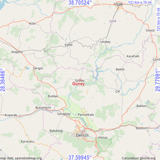
Güney GPS coordinates[2]
38° 9' 15.984" North, 29° 4' 4.008" East
| Map corner | latitude | longitude |
|---|---|---|
| Upper-left | 38.70524°, | 28.36466° |
| Center: | 38.15444°, | 29.06778° |
| Lower-right: | 37.59945°, | 29.77091° |
| Map W x H: | 123×123 km | = 76.4×76.4mi |
| max Lat: | 42.02683° ⇑58.7% North |
| Güney: | 38.15444° |
| min Lat: | ⇓41.3% South 35.9025° |
| min Long | Güney | max Long |
| 25.90902° | 29.06778° | 44.60099° |
| W 16.5%⇐ | ⇒83.5% E |
Elevation
Elevation of Güney is 752 m = 2467 ft, and this is 34.6 m = 114 ft above average elevation for this country.
| Max E: |
2682 m = 8799 ft | 47.2% |
| Güney | 752 m 2467 ft | |
| Avg. | 717.4 m = 2354 ft | |
Min E: |
0 m = 0 ft | 52.8% |
See also: Turkey elevation on elevation.city.
Geographical zone
Güney is located in North temperate zone (between Tropic of Cancer and the Arctic Circle). Distance of this Northern Tropic circle is 1636.5 km =1016.9 mi to South.| Distance of | km | miles | from Güney |
|---|---|---|---|
| North Pole | 5764.7 | 3582 | to North |
| Arctic Circle | 3158.8 | 1962.8 | to North |
| Tropic Cancer | 1636.5 | 1016.9 | to South |
| Equator | 4242.4 | 2636.1 | to South |


Nearby cities:
15 places around Güney: (largest is in red/bold)
• Akkent
27.2 km =16.9 mi,  90°
90°
• Akköy
22 km =13.7 mi,  177°
177°
• Bekilli
31.9 km =19.8 mi,  74°
74°
• Buharkent
35.5 km =22.1 mi,  233°
233°
• Buldan
24.1 km =15 mi,  239°
239°
• Eşme
28.6 km =17.8 mi,  342°
342°
• Gözler
9.2 km =5.7 mi,  125°
125°
• Güllü
13.4 km =8.3 mi,  13°
13°
• Merkezefendi
38.9 km =24.2 mi, 183°
• Pamukkale
26.8 km =16.7 mi,  170°
170°
• Pamukkale
40.5 km =25.2 mi, 175°
• Sarayköy
28.5 km =17.7 mi,  206°
206°
• Sarıgöl
33.8 km =21 mi,  286°
286°
• Ulubey
35.4 km =22 mi,  33°
33°
• Çal
30 km =18.6 mi,  105°
105°
Sources, notices
• [Note1] Compared only with cities in Turkey existing in our database
• [Src1] Map data: © OpenStreetMap contributors (CC-BY-SA)
• [Src2] Other city data from geonames.org with taken over terms of usage.
• [Src3] Geographical zone / Annual Mean Temperature by Robert A. Rohde @ Wikipedia
