Erzincan geodata
Erzincan is a seat of a first-order administrative division; located in Turkey in Europe/Istanbul (GMT+3) time zone. With population of 114,027 people, there are 76 cities with bigger population in this country. Compared to other cities in Turkey, 64.7% of cities are located further ↓South; 71.1% of cities are located further ←West and 80.1% of cities have lower elevation than Erzincan. Note1


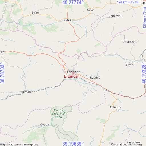
Erzincan GPS coordinates[2]
39° 44' 21.084" North, 39° 29' 24.54" East
| Map corner | latitude | longitude |
|---|---|---|
| Upper-left | 40.27774°, | 38.78703° |
| Center: | 39.73919°, | 39.49015° |
| Lower-right: | 39.19639°, | 40.19328° |
| Map W x H: | 120.2×120.2 km | = 74.7×74.7mi |
| max Lat: | 42.02683° ⇑35.3% North |
| Erzincan: | 39.73919° |
| min Lat: | ⇓64.7% South 35.9025° |
| min Long | Erzincan | max Long |
| 25.90902° | 39.49015° | 44.60099° |
| W 71.1%⇐ | ⇒28.9% E |
Elevation
Elevation of Erzincan is 1195 m = 3921 ft, and this is 477.6 m = 1567 ft above average elevation for this country.
| Max E: |
2682 m = 8799 ft | 19.9% |
| Erzincan | 1195 m 3921 ft | |
| Avg. | 717.4 m = 2354 ft | |
Min E: |
0 m = 0 ft | 80.1% |
See also: Erzincan elevation on elevation.city.
Geographical zone
Erzincan is located in North temperate zone (between Tropic of Cancer and the Arctic Circle). Distance of this Northern Tropic circle is 1812.7 km =1126.4 mi to South.| Distance of | km | miles | from Erzincan |
|---|---|---|---|
| North Pole | 5588.5 | 3472.5 | to North |
| Arctic Circle | 2982.6 | 1853.3 | to North |
| Tropic Cancer | 1812.7 | 1126.4 | to South |
| Equator | 4418.6 | 2745.6 | to South |


Nearby cities:
15 places around Erzincan: (largest is in red/bold)
• Alpköy
29.5 km =18.3 mi,  241°
241°
• Başköy
33.5 km =20.8 mi,  63°
63°
• Cimin
18.3 km =11.4 mi,  100°
100°
• Dağyolu
42.1 km =26.2 mi,  121°
121°
• Doğanbeyli
39.2 km =24.4 mi,  262°
262°
• Kelkit
43.4 km =27 mi,  353°
353°
• Kemah
43 km =26.7 mi,  248°
248°
• Mezraa
48.6 km =30.2 mi,  143°
143°
• Ovacık
49.3 km =30.6 mi,  209°
209°
• Pulumer
44.8 km =27.8 mi,  129°
129°
• Tanyeri
32.5 km =20.2 mi, 115°
• Turluk
47 km =29.2 mi, 135°
• Çatalarmut
16.5 km =10.3 mi,  295°
295°
• Çayırlı
46.6 km =29 mi,  80°
80°
• Çağlayan
24 km =14.9 mi, 135°
Sources, notices
• [Note1] Compared only with cities in Turkey existing in our database
• [Src1] Map data: © OpenStreetMap contributors (CC-BY-SA)
• [Src2] Other city data from geonames.org with taken over terms of usage.
• [Src3] Geographical zone / Annual Mean Temperature by Robert A. Rohde @ Wikipedia
