Başköy geodata
Başköy (Erzincan) is a seat of a third-order administrative division; located in Turkey in Europe/Istanbul (GMT+3) time zone. In our database, there are 1323 cities with bigger population. Compared to other cities in Turkey, 66.9% of cities are located further ↓South; 72.7% of cities are located further ←West and 97.2% of cities have lower elevation than Başköy. Note1


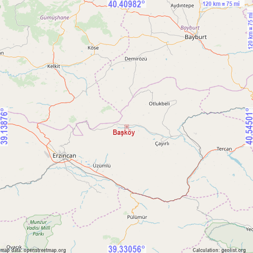
Başköy GPS coordinates[2]
39° 52' 20.316" North, 39° 50' 30.768" East
| Map corner | latitude | longitude |
|---|---|---|
| Upper-left | 40.40982°, | 39.13876° |
| Center: | 39.87231°, | 39.84188° |
| Lower-right: | 39.33056°, | 40.54501° |
| Map W x H: | 120×120 km | = 74.6×74.6mi |
| max Lat: | 42.02683° ⇑33.1% North |
| Başköy: | 39.87231° |
| min Lat: | ⇓66.9% South 35.9025° |
| min Long | Başköy | max Long |
| 25.90902° | 39.84188° | 44.60099° |
| W 72.7%⇐ | ⇒27.3% E |
Elevation
Elevation of Başköy is 1803 m = 5915 ft, and this is 1085.6 m = 3562 ft above average elevation for this country.
| Max E: |
2682 m = 8799 ft | 2.8% |
| Başköy | 1803 m 5915 ft | |
| Avg. | 717.4 m = 2354 ft | |
Min E: |
0 m = 0 ft | 97.2% |
See also: Turkey elevation on elevation.city.
Geographical zone
Başköy is located in North temperate zone (between Tropic of Cancer and the Arctic Circle). Distance of this Northern Tropic circle is 1827.5 km =1135.6 mi to South.| Distance of | km | miles | from Başköy |
|---|---|---|---|
| North Pole | 5573.7 | 3463.3 | to North |
| Arctic Circle | 2967.8 | 1844.1 | to North |
| Tropic Cancer | 1827.5 | 1135.6 | to South |
| Equator | 4433.4 | 2754.8 | to South |


Nearby cities:
15 places around Başköy: (largest is in red/bold)
• Cimin
21.8 km =13.5 mi,  213°
213°
• Dağyolu
37.5 km =23.3 mi,  171°
171°
• Erzincan
33.5 km =20.8 mi,  243°
243°
• Kelkit
44.8 km =27.8 mi,  309°
309°
• Köse
40.8 km =25.4 mi,  335°
335°
• Otlukbeli
18.6 km =11.6 mi,  54°
54°
• Pulumer
43.4 km =27 mi, 173°
• Pulur
32.3 km =20.1 mi,  7°
7°
• Tanyeri
29 km =18 mi,  181°
181°
• Tercan
47 km =29.2 mi,  103°
103°
• Turluk
48.1 km =29.9 mi, 176°
• Çatalarmut
45.6 km =28.3 mi,  260°
260°
• Çayırlı
17.4 km =10.8 mi,  114°
114°
• Çağlayan
34.6 km =21.5 mi,  202°
202°
• Üçdam
44.7 km =27.8 mi,  140°
140°
Sources, notices
• [Note1] Compared only with cities in Turkey existing in our database
• [Src1] Map data: © OpenStreetMap contributors (CC-BY-SA)
• [Src2] Other city data from geonames.org with taken over terms of usage.
• [Src3] Geographical zone / Annual Mean Temperature by Robert A. Rohde @ Wikipedia
