Bulucan geodata
Bulucan (Sivas) is a seat of a third-order administrative division; located in Turkey in Europe/Istanbul (GMT+3) time zone. In our database, there are 1323 cities with bigger population. Compared to other cities in Turkey, 64.4% of cities are located further ↓South; 60.2% of cities are located further ←West and 90.7% of cities have lower elevation than Bulucan. Note1


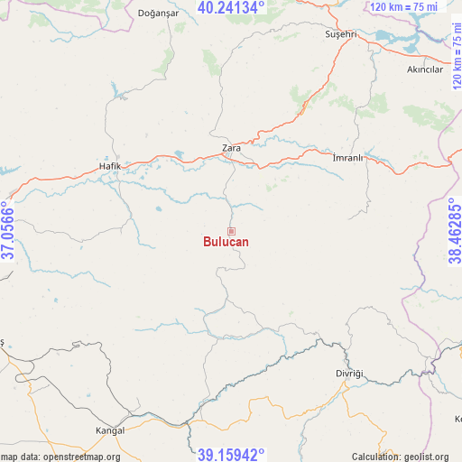
Bulucan GPS coordinates[2]
39° 42' 9" North, 37° 45' 34.992" East
| Map corner | latitude | longitude |
|---|---|---|
| Upper-left | 40.24134°, | 37.0566° |
| Center: | 39.7025°, | 37.75972° |
| Lower-right: | 39.15942°, | 38.46285° |
| Map W x H: | 120.3×120.3 km | = 74.8×74.8mi |
| max Lat: | 42.02683° ⇑35.6% North |
| Bulucan: | 39.7025° |
| min Lat: | ⇓64.4% South 35.9025° |
| min Long | Bulucan | max Long |
| 25.90902° | 37.75972° | 44.60099° |
| W 60.2%⇐ | ⇒39.8% E |
Elevation
Elevation of Bulucan is 1501 m = 4925 ft, and this is 783.6 m = 2571 ft above average elevation for this country.
| Max E: |
2682 m = 8799 ft | 9.3% |
| Bulucan | 1501 m 4925 ft | |
| Avg. | 717.4 m = 2354 ft | |
Min E: |
0 m = 0 ft | 90.7% |
See also: Turkey elevation on elevation.city.
Geographical zone
Bulucan is located in North temperate zone (between Tropic of Cancer and the Arctic Circle). Distance of this Northern Tropic circle is 1808.6 km =1123.8 mi to South.| Distance of | km | miles | from Bulucan |
|---|---|---|---|
| North Pole | 5592.6 | 3475.1 | to North |
| Arctic Circle | 2986.7 | 1855.8 | to North |
| Tropic Cancer | 1808.6 | 1123.8 | to South |
| Equator | 4414.5 | 2743 | to South |


Nearby cities:
15 places around Bulucan: (largest is in red/bold)
• Aksu
49 km =30.4 mi,  28°
28°
• Beypınarı
22.3 km =13.9 mi,  191°
191°
• Celâlli
28.8 km =17.9 mi,  267°
267°
• Divriği
47.7 km =29.6 mi,  140°
140°
• Gedikbaşı
48 km =29.8 mi,  119°
119°
• Hafik
36.2 km =22.5 mi,  298°
298°
• Karacaören
30.6 km =19 mi,  84°
84°
• Karayün
38.9 km =24.2 mi, 266°
• Kavak
51.5 km =32 mi,  207°
207°
• Sincan
27.4 km =17 mi,  159°
159°
• Suşehri
57.9 km =36 mi, 28°
• Zara
21.7 km =13.5 mi,  359°
359°
• Çetinkaya
50.3 km =31.3 mi, 193°
• İmranlı
35.8 km =22.2 mi,  57°
57°
• Şerefiye
45.5 km =28.3 mi, 359°
Sources, notices
• [Note1] Compared only with cities in Turkey existing in our database
• [Src1] Map data: © OpenStreetMap contributors (CC-BY-SA)
• [Src2] Other city data from geonames.org with taken over terms of usage.
• [Src3] Geographical zone / Annual Mean Temperature by Robert A. Rohde @ Wikipedia
