Dikboğaz geodata
Dikboğaz (Siirt) is a populated place; located in Turkey in Europe/Istanbul (GMT+3) time zone. With population of 898 people, there are 1118 cities with bigger population in this country. Compared to other cities in Turkey, 70.8% of cities are located further ↑North; 91.2% of cities are located further ←West and 86.9% of cities have lower elevation than Dikboğaz. Note1


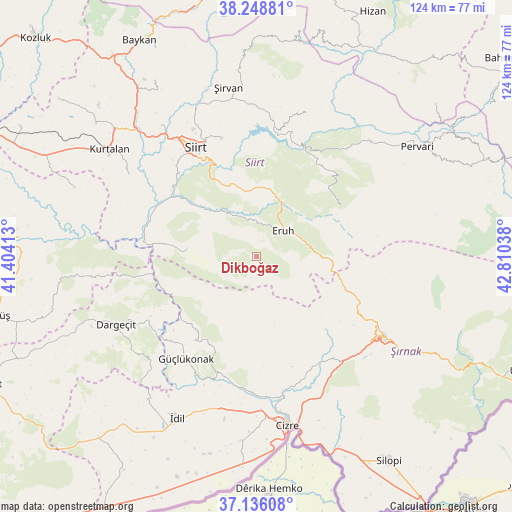
Dikboğaz GPS coordinates[2]
37° 41' 40.308" North, 42° 6' 26.1" East
| Map corner | latitude | longitude |
|---|---|---|
| Upper-left | 38.24881°, | 41.40413° |
| Center: | 37.69453°, | 42.10725° |
| Lower-right: | 37.13608°, | 42.81038° |
| Map W x H: | 123.7×123.7 km | = 76.9×76.9mi |
| max Lat: | 42.02683° ⇑70.8% North |
| Dikboğaz: | 37.69453° |
| min Lat: | ⇓29.2% South 35.9025° |
| min Long | Dikboğaz | max Long |
| 25.90902° | 42.10725° | 44.60099° |
| W 91.2%⇐ | ⇒8.8% E |
Elevation
Elevation of Dikboğaz is 1364 m = 4475 ft, and this is 646.6 m = 2121 ft above average elevation for this country.
| Max E: |
2682 m = 8799 ft | 13.1% |
| Dikboğaz | 1364 m 4475 ft | |
| Avg. | 717.4 m = 2354 ft | |
Min E: |
0 m = 0 ft | 86.9% |
See also: Turkey elevation on elevation.city.
Geographical zone
Dikboğaz is located in North temperate zone (between Tropic of Cancer and the Arctic Circle). Distance of this Northern Tropic circle is 1585.3 km =985.1 mi to South.| Distance of | km | miles | from Dikboğaz |
|---|---|---|---|
| North Pole | 5815.8 | 3613.8 | to North |
| Arctic Circle | 3209.9 | 1994.5 | to North |
| Tropic Cancer | 1585.3 | 985.1 | to South |
| Equator | 4191.2 | 2604.3 | to South |


Nearby cities:
15 places around Dikboğaz: (largest is in red/bold)
• Doğanca
22.9 km =14.2 mi,  59°
59°
• Ekmekçiler
21.3 km =13.2 mi,  4°
4°
• Erenkaya
7.7 km =4.8 mi,  210°
210°
• Eruh
7.9 km =4.9 mi,  48°
48°
• Fındık
23.8 km =14.8 mi, 212°
• Gölgelikonak
8.5 km =5.3 mi,  12°
12°
• Kayaboyun
24.6 km =15.3 mi,  180°
180°
• Koçtepe
27.1 km =16.8 mi,  231°
231°
• Kızılsu
27.9 km =17.3 mi,  163°
163°
• Lodi
17 km =10.6 mi,  276°
276°
• Meydandere
25.7 km =16 mi,  357°
357°
• Palamutlu
23.9 km =14.9 mi,  20°
20°
• Serhatta
4.6 km =2.9 mi,  140°
140°
• Temelli
26.6 km =16.5 mi,  240°
240°
• Yelkesen
11.8 km =7.3 mi,  249°
249°
Sources, notices
• [Note1] Compared only with cities in Turkey existing in our database
• [Src1] Map data: © OpenStreetMap contributors (CC-BY-SA)
• [Src2] Other city data from geonames.org with taken over terms of usage.
• [Src3] Geographical zone / Annual Mean Temperature by Robert A. Rohde @ Wikipedia
