Karchane geodata
Karchane (Şırnak) is a populated place; located in Turkey in Europe/Istanbul (GMT+3) time zone. With population of 507 people, there are 1307 cities with bigger population in this country. Compared to other cities in Turkey, 71.8% of cities are located further ↑North; 97.5% of cities are located further ←West and 93.8% of cities have lower elevation than Karchane. Note1


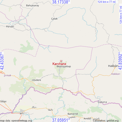
Karchane GPS coordinates[2]
37° 37' 6.708" North, 43° 8' 12.444" East
| Map corner | latitude | longitude |
|---|---|---|
| Upper-left | 38.17338°, | 42.43367° |
| Center: | 37.61853°, | 43.13679° |
| Lower-right: | 37.05951°, | 43.83992° |
| Map W x H: | 123.9×123.9 km | = 77×77mi |
| max Lat: | 42.02683° ⇑71.8% North |
| Karchane: | 37.61853° |
| min Lat: | ⇓28.2% South 35.9025° |
| min Long | Karchane | max Long |
| 25.90902° | 43.13679° | 44.60099° |
| W 97.5%⇐ | ⇒2.5% E |
Elevation
Elevation of Karchane is 1625 m = 5331 ft, and this is 907.6 m = 2978 ft above average elevation for this country.
| Max E: |
2682 m = 8799 ft | 6.2% |
| Karchane | 1625 m 5331 ft | |
| Avg. | 717.4 m = 2354 ft | |
Min E: |
0 m = 0 ft | 93.8% |
See also: Turkey elevation on elevation.city.
Geographical zone
Karchane is located in North temperate zone (between Tropic of Cancer and the Arctic Circle). Distance of this Northern Tropic circle is 1576.9 km =979.8 mi to South.| Distance of | km | miles | from Karchane |
|---|---|---|---|
| North Pole | 5824.3 | 3619.1 | to North |
| Arctic Circle | 3218.4 | 1999.8 | to North |
| Tropic Cancer | 1576.9 | 979.8 | to South |
| Equator | 4182.8 | 2599.1 | to South |


Nearby cities:
15 places around Karchane: (largest is in red/bold)
• Andaç
31.4 km =19.5 mi,  159°
159°
• Aşağıdere
11.8 km =7.3 mi,  187°
187°
• Başaran
15.8 km =9.8 mi,  182°
182°
• Becuh
28.4 km =17.6 mi,  207°
207°
• Beytüşşebap
6.7 km =4.2 mi, 157°
• Bolağaç
15.9 km =9.9 mi, 213°
• Boğazören
15.2 km =9.4 mi,  228°
228°
• Buğdaylı
11.1 km =6.9 mi,  47°
47°
• Dağdibi
25.2 km =15.7 mi, 187°
• Konalga
27.1 km =16.8 mi,  352°
352°
• Mezraa
6.7 km =4.2 mi,  43°
43°
• Oymakaya
23.2 km =14.4 mi, 158°
• Pirinçli
14 km =8.7 mi,  219°
219°
• Uzungeçit
19.2 km =11.9 mi, 222°
• Yemişli
28.4 km =17.6 mi, 190°
Sources, notices
• [Note1] Compared only with cities in Turkey existing in our database
• [Src1] Map data: © OpenStreetMap contributors (CC-BY-SA)
• [Src2] Other city data from geonames.org with taken over terms of usage.
• [Src3] Geographical zone / Annual Mean Temperature by Robert A. Rohde @ Wikipedia
