Buğdaylı geodata
Buğdaylı (Şırnak) is a populated place; located in Turkey in Europe/Istanbul (GMT+3) time zone. With population of 944 people, there are 1103 cities with bigger population in this country. Compared to other cities in Turkey, 70.9% of cities are located further ↑North; 97.8% of cities are located further ←West and 99.8% of cities have lower elevation than Buğdaylı. Note1


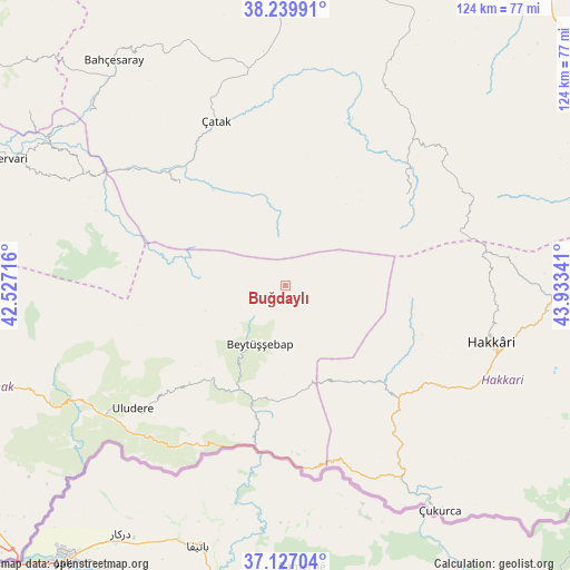
Buğdaylı GPS coordinates[2]
37° 41' 8.016" North, 43° 13' 49.008" East
| Map corner | latitude | longitude |
|---|---|---|
| Upper-left | 38.23991°, | 42.52716° |
| Center: | 37.68556°, | 43.23028° |
| Lower-right: | 37.12704°, | 43.93341° |
| Map W x H: | 123.7×123.7 km | = 76.9×76.9mi |
| max Lat: | 42.02683° ⇑70.9% North |
| Buğdaylı: | 37.68556° |
| min Lat: | ⇓29.1% South 35.9025° |
| min Long | Buğdaylı | max Long |
| 25.90902° | 43.23028° | 44.60099° |
| W 97.8%⇐ | ⇒2.2% E |
Elevation
Elevation of Buğdaylı is 2248 m = 7375 ft, and this is 1530.6 m = 5022 ft above average elevation for this country.
| Max E: |
2682 m = 8799 ft | 0.2% |
| Buğdaylı | 2248 m 7375 ft | |
| Avg. | 717.4 m = 2354 ft | |
Min E: |
0 m = 0 ft | 99.8% |
See also: Turkey elevation on elevation.city.
Geographical zone
Buğdaylı is located in North temperate zone (between Tropic of Cancer and the Arctic Circle). Distance of this Northern Tropic circle is 1584.3 km =984.4 mi to South.| Distance of | km | miles | from Buğdaylı |
|---|---|---|---|
| North Pole | 5816.8 | 3614.4 | to North |
| Arctic Circle | 3210.9 | 1995.2 | to North |
| Tropic Cancer | 1584.3 | 984.4 | to South |
| Equator | 4190.2 | 2603.7 | to South |


Nearby cities:
15 places around Buğdaylı: (largest is in red/bold)
• Aşağıdere
21.5 km =13.4 mi,  206°
206°
• Başaran
24.9 km =15.5 mi,  200°
200°
• Beytüşşebap
14.7 km =9.1 mi, 202°
• Bolağaç
26.8 km =16.7 mi,  219°
219°
• Boğazören
26.3 km =16.3 mi,  228°
228°
• Dağdibi
34.4 km =21.4 mi, 199°
• Geçitli
31.2 km =19.4 mi,  110°
110°
• Karchane
11.1 km =6.9 mi, 227°
• Konalga
22.7 km =14.1 mi,  328°
328°
• Mezraa
4.5 km =2.8 mi, 234°
• Narlı
31.4 km =19.5 mi,  314°
314°
• Oymakaya
29.1 km =18.1 mi,  179°
179°
• Pirinçli
25 km =15.5 mi, 223°
• Uzungeçit
30.3 km =18.8 mi, 224°
• Yalınca
31.9 km =19.8 mi,  53°
53°
Sources, notices
• [Note1] Compared only with cities in Turkey existing in our database
• [Src1] Map data: © OpenStreetMap contributors (CC-BY-SA)
• [Src2] Other city data from geonames.org with taken over terms of usage.
• [Src3] Geographical zone / Annual Mean Temperature by Robert A. Rohde @ Wikipedia
