Yomra geodata
Yomra (Trabzon) is a seat of a second-order administrative division; located in Turkey in Europe/Istanbul (GMT+3) time zone. With population of 19,770 people, there are 335 cities with bigger population in this country. Compared to other cities in Turkey, 87.9% of cities are located further ↓South; 72.7% of cities are located further ←West and 84.1% of cities have higher elevation than Yomra. Note1


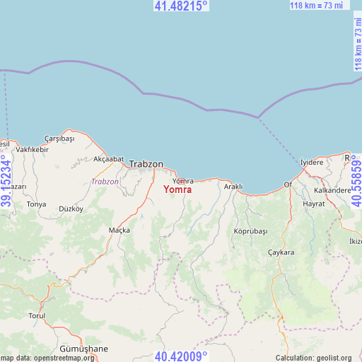
Yomra GPS coordinates[2]
40° 57' 11.736" North, 39° 51' 19.656" East
| Map corner | latitude | longitude |
|---|---|---|
| Upper-left | 41.48215°, | 39.15234° |
| Center: | 40.95326°, | 39.85546° |
| Lower-right: | 40.42009°, | 40.55859° |
| Map W x H: | 118.1×118.1 km | = 73.4×73.4mi |
| max Lat: | 42.02683° ⇑12.1% North |
| Yomra: | 40.95326° |
| min Lat: | ⇓87.9% South 35.9025° |
| min Long | Yomra | max Long |
| 25.90902° | 39.85546° | 44.60099° |
| W 72.7%⇐ | ⇒27.3% E |
Elevation
Elevation of Yomra is 79 m = 259 ft, and this is 638.4 m = 2094 ft below average elevation for this country.
| Max E: |
2682 m = 8799 ft | 84.1% |
| Avg. | 717.4 m = 2354 ft | |
| Yomra | 79 m = 259 ft | |
Min E: |
0 m = 0 ft | 15.9% |
See also: Turkey elevation on elevation.city.
Geographical zone
Yomra is located in North temperate zone (between Tropic of Cancer and the Arctic Circle). Distance of this Northern Tropic circle is 1947.7 km =1210.2 mi to South.| Distance of | km | miles | from Yomra |
|---|---|---|---|
| North Pole | 5453.5 | 3388.6 | to North |
| Arctic Circle | 2847.6 | 1769.4 | to North |
| Tropic Cancer | 1947.7 | 1210.2 | to South |
| Equator | 4553.6 | 2829.5 | to South |


Nearby cities:
15 places around Yomra: (largest is in red/bold)
• Akçaabat
25 km =15.5 mi,  287°
287°
• Araklı
17.1 km =10.6 mi,  95°
95°
• Arsin
6 km =3.7 mi,  90°
90°
• Dağbaşı
25.5 km =15.8 mi,  169°
169°
• Derecik
22 km =13.7 mi,  267°
267°
• Dernekpazarı
37.1 km =23.1 mi,  118°
118°
• Esiroğlu
16.6 km =10.3 mi,  237°
237°
• Köprübaşı
27.2 km =16.9 mi,  126°
126°
• Küçükdere
23.3 km =14.5 mi, 134°
• Maçka
26.4 km =16.4 mi,  233°
233°
• Of
33.9 km =21.1 mi, 92°
• Sürmene
23.5 km =14.6 mi, 102°
• Tosköy
15.2 km =9.4 mi,  264°
264°
• Trabzon
12.2 km =7.6 mi,  298°
298°
• Çağlayan
13.4 km =8.3 mi, 243°
Sources, notices
• [Note1] Compared only with cities in Turkey existing in our database
• [Src1] Map data: © OpenStreetMap contributors (CC-BY-SA)
• [Src2] Other city data from geonames.org with taken over terms of usage.
• [Src3] Geographical zone / Annual Mean Temperature by Robert A. Rohde @ Wikipedia
