Dernekpazarı geodata
Dernekpazarı (Trabzon) is a seat of a second-order administrative division; located in Turkey in Europe/Istanbul (GMT+3) time zone. With population of 6,880 people, there are 613 cities with bigger population in this country. Compared to other cities in Turkey, 83.5% of cities are located further ↓South; 75.3% of cities are located further ←West and 72.3% of cities have higher elevation than Dernekpazarı. Note1


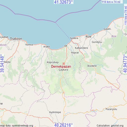
Dernekpazarı GPS coordinates[2]
40° 47' 47.688" North, 40° 14' 40.56" East
| Map corner | latitude | longitude |
|---|---|---|
| Upper-left | 41.32673°, | 39.54148° |
| Center: | 40.79658°, | 40.2446° |
| Lower-right: | 40.26216°, | 40.94773° |
| Map W x H: | 118.4×118.4 km | = 73.6×73.6mi |
| max Lat: | 42.02683° ⇑16.5% North |
| Dernekpazarı: | 40.79658° |
| min Lat: | ⇓83.5% South 35.9025° |
| min Long | Dernekpazarı | max Long |
| 25.90902° | 40.2446° | 44.60099° |
| W 75.3%⇐ | ⇒24.7% E |
Elevation
Elevation of Dernekpazarı is 229 m = 751 ft, and this is 488.4 m = 1602 ft below average elevation for this country.
| Max E: |
2682 m = 8799 ft | 72.3% |
| Avg. | 717.4 m = 2354 ft | |
| Dernekpazarı | 229 m = 751 ft | |
Min E: |
0 m = 0 ft | 27.7% |
See also: Turkey elevation on elevation.city.
Geographical zone
Dernekpazarı is located in North temperate zone (between Tropic of Cancer and the Arctic Circle). Distance of this Northern Tropic circle is 1930.2 km =1199.4 mi to South.| Distance of | km | miles | from Dernekpazarı |
|---|---|---|---|
| North Pole | 5470.9 | 3399.5 | to North |
| Arctic Circle | 2865 | 1780.2 | to North |
| Tropic Cancer | 1930.2 | 1199.4 | to South |
| Equator | 4536.2 | 2818.7 | to South |


Nearby cities:
15 places around Dernekpazarı: (largest is in red/bold)
• Araklı
22.2 km =13.8 mi,  315°
315°
• Arsin
31.9 km =19.8 mi,  303°
303°
• Dağbaşı
29.1 km =18.1 mi,  254°
254°
• Derepazarı
29.4 km =18.3 mi,  30°
30°
• Güneyce
19.2 km =11.9 mi,  81°
81°
• Hayrat
14.1 km =8.8 mi,  45°
45°
• Kalkandere
21.2 km =13.2 mi, 49°
• Köprübaşı
11 km =6.8 mi,  275°
275°
• Küçükdere
16 km =9.9 mi,  274°
274°
• Of
16.1 km =10 mi,  4°
4°
• Sürmene
15.6 km =9.7 mi, 321°
• Uzungöl
20.4 km =12.7 mi,  169°
169°
• Çaykara
6.1 km =3.8 mi,  190°
190°
• İkizdere
26 km =16.2 mi,  95°
95°
• İyidere
25.9 km =16.1 mi,  22°
22°
Sources, notices
• [Note1] Compared only with cities in Turkey existing in our database
• [Src1] Map data: © OpenStreetMap contributors (CC-BY-SA)
• [Src2] Other city data from geonames.org with taken over terms of usage.
• [Src3] Geographical zone / Annual Mean Temperature by Robert A. Rohde @ Wikipedia
