Yavuzkemal geodata
Yavuzkemal (Giresun) is a seat of a third-order administrative division; located in Turkey in Europe/Istanbul (GMT+3) time zone. In our database, there are 1323 cities with bigger population. Compared to other cities in Turkey, 81% of cities are located further ↓South; 63.2% of cities are located further ←West and 94.6% of cities have lower elevation than Yavuzkemal. Note1


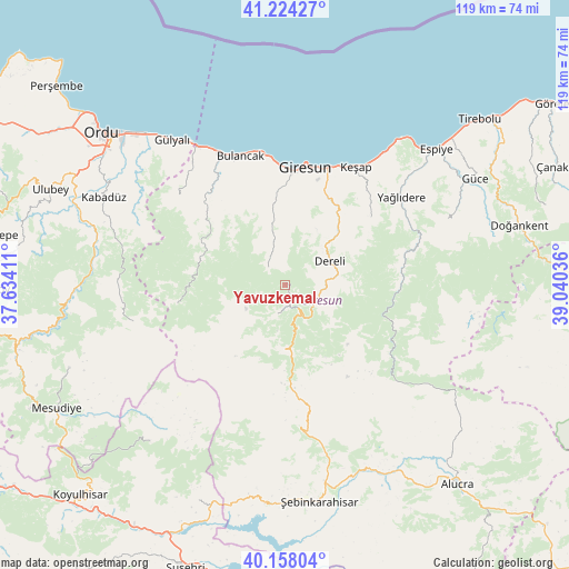
Yavuzkemal GPS coordinates[2]
40° 41' 35.844" North, 38° 20' 14.028" East
| Map corner | latitude | longitude |
|---|---|---|
| Upper-left | 41.22427°, | 37.63411° |
| Center: | 40.69329°, | 38.33723° |
| Lower-right: | 40.15804°, | 39.04036° |
| Map W x H: | 118.6×118.6 km | = 73.7×73.7mi |
| max Lat: | 42.02683° ⇑19% North |
| Yavuzkemal: | 40.69329° |
| min Lat: | ⇓81% South 35.9025° |
| min Long | Yavuzkemal | max Long |
| 25.90902° | 38.33723° | 44.60099° |
| W 63.2%⇐ | ⇒36.8% E |
Elevation
Elevation of Yavuzkemal is 1663 m = 5456 ft, and this is 945.6 m = 3102 ft above average elevation for this country.
| Max E: |
2682 m = 8799 ft | 5.4% |
| Yavuzkemal | 1663 m 5456 ft | |
| Avg. | 717.4 m = 2354 ft | |
Min E: |
0 m = 0 ft | 94.6% |
See also: Turkey elevation on elevation.city.
Geographical zone
Yavuzkemal is located in North temperate zone (between Tropic of Cancer and the Arctic Circle). Distance of this Northern Tropic circle is 1918.8 km =1192.3 mi to South.| Distance of | km | miles | from Yavuzkemal |
|---|---|---|---|
| North Pole | 5482.4 | 3406.6 | to North |
| Arctic Circle | 2876.5 | 1787.4 | to North |
| Tropic Cancer | 1918.8 | 1192.3 | to South |
| Equator | 4524.7 | 2811.5 | to South |


Nearby cities:
15 places around Yavuzkemal: (largest is in red/bold)
• Bulancak
28.6 km =17.8 mi,  341°
341°
• Dereli
10.3 km =6.4 mi,  60°
60°
• Espiye
41.8 km =26 mi,  47°
47°
• Giresun
25.2 km =15.7 mi,  9°
9°
• Güce
44.7 km =27.8 mi, 60°
• Gülyalı
38.4 km =23.9 mi,  320°
320°
• Kabadüz
42.4 km =26.3 mi,  296°
296°
• Karabulduk
22.8 km =14.2 mi, 51°
• Keşap
27.8 km =17.3 mi,  29°
29°
• Kovanlık
20.2 km =12.6 mi,  289°
289°
• Ortakent
43.3 km =26.9 mi,  219°
219°
• Piraziz
31.1 km =19.3 mi, 324°
• Piraziz
34.7 km =21.6 mi,  326°
326°
• Yağlıdere
30 km =18.6 mi, 52°
• Şebin Karahisar
45.6 km =28.3 mi,  170°
170°
Sources, notices
• [Note1] Compared only with cities in Turkey existing in our database
• [Src1] Map data: © OpenStreetMap contributors (CC-BY-SA)
• [Src2] Other city data from geonames.org with taken over terms of usage.
• [Src3] Geographical zone / Annual Mean Temperature by Robert A. Rohde @ Wikipedia
