Kabadüz geodata
Kabadüz (Ordu) is a seat of a second-order administrative division; located in Turkey in Europe/Istanbul (GMT+3) time zone. With population of 3,642 people, there are 812 cities with bigger population in this country. Compared to other cities in Turkey, 85% of cities are located further ↓South; 61.2% of cities are located further ←West and 59.8% of cities have higher elevation than Kabadüz. Note1


Kabadüz GPS coordinates[2]
40° 51' 39.456" North, 37° 53' 4.92" East
| Map corner | latitude | longitude |
|---|---|---|
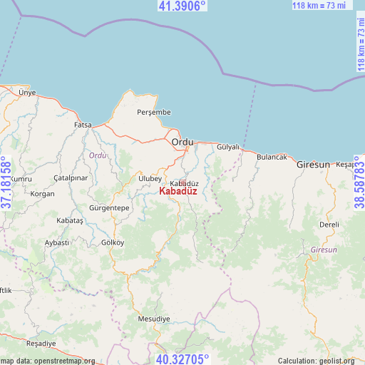
| Upper-left | 41.3906°, | 37.18158° |
| Center: | 40.86096°, | 37.8847° |
| Lower-right: | 40.32705°, | 38.58783° |
| Map W x H: | 118.3×118.3 km | = 73.5×73.5mi |
| max Lat: | 42.02683° ⇑15% North |
| Kabadüz: | 40.86096° |
| min Lat: | ⇓85% South 35.9025° |
| min Long | Kabadüz | max Long |
| 25.90902° | 37.8847° | 44.60099° |
| W 61.2%⇐ | ⇒38.8% E |
Elevation
Elevation of Kabadüz is 510 m = 1673 ft, and this is 207.4 m = 680 ft below average elevation for this country.
| Max E: |
2682 m = 8799 ft | 59.8% |
| Avg. | 717.4 m = 2354 ft | |
| Kabadüz | 510 m = 1673 ft | |
Min E: |
0 m = 0 ft | 40.2% |
See also: Turkey elevation on elevation.city.
Geographical zone
Kabadüz is located in North temperate zone (between Tropic of Cancer and the Arctic Circle). Distance of this Northern Tropic circle is 1937.4 km =1203.8 mi to South.| Distance of | km | miles | from Kabadüz |
|---|---|---|---|
| North Pole | 5463.7 | 3395 | to North |
| Arctic Circle | 2857.9 | 1775.8 | to North |
| Tropic Cancer | 1937.4 | 1203.8 | to South |
| Equator | 4543.3 | 2823.1 | to South |


Nearby cities:
15 places around Kabadüz: (largest is in red/bold)
• Altınordu
13.7 km =8.5 mi,  356°
356°
• Bolaman
31.1 km =19.3 mi,  308°
308°
• Bulancak
30.4 km =18.9 mi,  73°
73°
• Gölköy
29.8 km =18.5 mi,  229°
229°
• Gülyalı
17.8 km =11.1 mi,  51°
51°
• Gürgentepe
26.2 km =16.3 mi,  251°
251°
• Kovanlık
22.4 km =13.9 mi,  121°
121°
• Ordu
13 km =8.1 mi,  2°
2°
• Perşembe
24.7 km =15.3 mi,  337°
337°
• Piraziz
21.3 km =13.2 mi, 71°
• Piraziz
21.4 km =13.3 mi,  61°
61°
• Topçam
28.8 km =17.9 mi,  199°
199°
• Ulubey
11 km =6.8 mi,  274°
274°
• Uzunisa
6.7 km =4.2 mi,  332°
332°
• Çamaş
30.3 km =18.8 mi,  278°
278°
Sources, notices
• [Note1] Compared only with cities in Turkey existing in our database
• [Src1] Map data: © OpenStreetMap contributors (CC-BY-SA)
• [Src2] Other city data from geonames.org with taken over terms of usage.
• [Src3] Geographical zone / Annual Mean Temperature by Robert A. Rohde @ Wikipedia
