Umurbey geodata
Umurbey (Bursa) is a populated place; located in Turkey in Europe/Istanbul (GMT+3) time zone. With population of 3,479 people, there are 822 cities with bigger population in this country. Compared to other cities in Turkey, 76.5% of cities are located further ↓South; 82% of cities are located further →East and 72.2% of cities have higher elevation than Umurbey. Note1


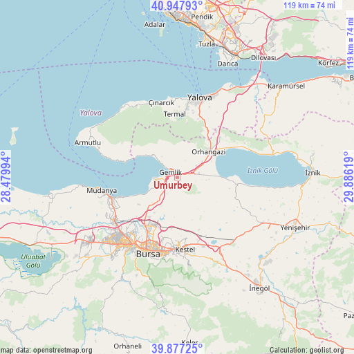
Umurbey GPS coordinates[2]
40° 24' 52.992" North, 29° 10' 59.016" East
| Map corner | latitude | longitude |
|---|---|---|
| Upper-left | 40.94793°, | 28.47994° |
| Center: | 40.41472°, | 29.18306° |
| Lower-right: | 39.87725°, | 29.88619° |
| Map W x H: | 119×119 km | = 73.9×73.9mi |
| max Lat: | 42.02683° ⇑23.5% North |
| Umurbey: | 40.41472° |
| min Lat: | ⇓76.5% South 35.9025° |
| min Long | Umurbey | max Long |
| 25.90902° | 29.18306° | 44.60099° |
| W 18%⇐ | ⇒82% E |
Elevation
Elevation of Umurbey is 230 m = 755 ft, and this is 487.4 m = 1599 ft below average elevation for this country.
| Max E: |
2682 m = 8799 ft | 72.2% |
| Avg. | 717.4 m = 2354 ft | |
| Umurbey | 230 m = 755 ft | |
Min E: |
0 m = 0 ft | 27.8% |
See also: Turkey elevation on elevation.city.
Geographical zone
Umurbey is located in North temperate zone (between Tropic of Cancer and the Arctic Circle). Distance of this Northern Tropic circle is 1887.8 km =1173 mi to South.| Distance of | km | miles | from Umurbey |
|---|---|---|---|
| North Pole | 5513.4 | 3425.9 | to North |
| Arctic Circle | 2907.5 | 1806.6 | to North |
| Tropic Cancer | 1887.8 | 1173 | to South |
| Equator | 4493.7 | 2792.3 | to South |


Nearby cities:
15 places around Umurbey: (largest is in red/bold)
• Demirtaş
17.4 km =10.8 mi,  204°
204°
• Gemlik
2.7 km =1.7 mi,  312°
312°
• Gölcük
22.6 km =14 mi,  132°
132°
• Gürsu
21.8 km =13.5 mi,  177°
177°
• Kadıköy
23.1 km =14.4 mi,  8°
8°
• Karacaali
12.1 km =7.5 mi, 306°
• Kestel
24.2 km =15 mi,  174°
174°
• Küçükkumla
9.3 km =5.8 mi, 311°
• Narlıca
25.4 km =15.8 mi,  97°
97°
• Orhangazi
13.5 km =8.4 mi,  52°
52°
• Seçköy
10.2 km =6.3 mi, 173°
• Sölöz
19.8 km =12.3 mi, 96°
• Termal
21.5 km =13.4 mi,  357°
357°
• Yeniköy
19.7 km =12.2 mi, 47°
• Çakırlı
25.5 km =15.8 mi,  63°
63°
Sources, notices
• [Note1] Compared only with cities in Turkey existing in our database
• [Src1] Map data: © OpenStreetMap contributors (CC-BY-SA)
• [Src2] Other city data from geonames.org with taken over terms of usage.
• [Src3] Geographical zone / Annual Mean Temperature by Robert A. Rohde @ Wikipedia
