Umurbey geodata
Umurbey (Canakkale) is a seat of a third-order administrative division; located in Turkey in Europe/Istanbul (GMT+3) time zone. In our database, there are 1323 cities with bigger population. Compared to other cities in Turkey, 73.3% of cities are located further ↓South; 98.8% of cities are located further →East and 80.5% of cities have higher elevation than Umurbey. Note1


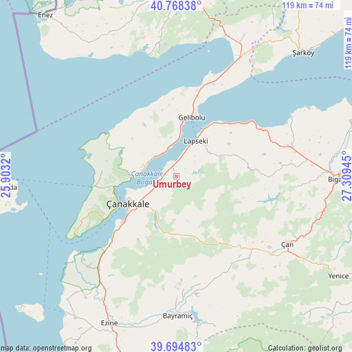
Umurbey GPS coordinates[2]
40° 14' 1.428" North, 26° 36' 22.752" East
| Map corner | latitude | longitude |
|---|---|---|
| Upper-left | 40.76838°, | 25.9032° |
| Center: | 40.23373°, | 26.60632° |
| Lower-right: | 39.69483°, | 27.30945° |
| Map W x H: | 119.4×119.4 km | = 74.2×74.2mi |
| max Lat: | 42.02683° ⇑26.7% North |
| Umurbey: | 40.23373° |
| min Lat: | ⇓73.3% South 35.9025° |
| min Long | Umurbey | max Long |
| 25.90902° | 26.60632° | 44.60099° |
| W 1.2%⇐ | ⇒98.8% E |
Elevation
Elevation of Umurbey is 112 m = 367 ft, and this is 605.4 m = 1986 ft below average elevation for this country.
| Max E: |
2682 m = 8799 ft | 80.5% |
| Avg. | 717.4 m = 2354 ft | |
| Umurbey | 112 m = 367 ft | |
Min E: |
0 m = 0 ft | 19.5% |
See also: Turkey elevation on elevation.city.
Geographical zone
Umurbey is located in North temperate zone (between Tropic of Cancer and the Arctic Circle). Distance of this Northern Tropic circle is 1867.7 km =1160.5 mi to South.| Distance of | km | miles | from Umurbey |
|---|---|---|---|
| North Pole | 5533.5 | 3438.4 | to North |
| Arctic Circle | 2927.6 | 1819.1 | to North |
| Tropic Cancer | 1867.7 | 1160.5 | to South |
| Equator | 4473.6 | 2779.8 | to South |


Nearby cities:
15 places around Umurbey: (largest is in red/bold)
• Bakacak
40.6 km =25.2 mi,  94°
94°
• Balıklıçeşme
41.2 km =25.6 mi,  78°
78°
• Beyçayırı
27.1 km =16.8 mi, 84°
• Bolayır
33.8 km =21 mi,  22°
22°
• Eceabat
21.8 km =13.5 mi,  255°
255°
• Etili
37 km =23 mi,  138°
138°
• Gelibolu
20.4 km =12.7 mi, 15°
• Gündoğdu
41.4 km =25.7 mi, 85°
• Kirazlı
22.8 km =14.2 mi,  159°
159°
• Lapseki
14 km =8.7 mi,  28°
28°
• Merkez
19.6 km =12.2 mi,  233°
233°
• Yiğitler
40.7 km =25.3 mi,  179°
179°
• Çan
44 km =27.3 mi,  120°
120°
• Çanakkale
18.6 km =11.6 mi,  242°
242°
• İntepe
33.8 km =21 mi,  223°
223°
Sources, notices
• [Note1] Compared only with cities in Turkey existing in our database
• [Src1] Map data: © OpenStreetMap contributors (CC-BY-SA)
• [Src2] Other city data from geonames.org with taken over terms of usage.
• [Src3] Geographical zone / Annual Mean Temperature by Robert A. Rohde @ Wikipedia
