Büyükkarıştıran geodata
Büyükkarıştıran (Kırklareli) is a seat of a third-order administrative division; located in Turkey in Europe/Istanbul (GMT+3) time zone. In our database, there are 1323 cities with bigger population. Compared to other cities in Turkey, 95.7% of cities are located further ↓South; 93.4% of cities are located further →East and 84.4% of cities have higher elevation than Büyükkarıştıran. Note1


Büyükkarıştıran GPS coordinates[2]
41° 18' 1.008" North, 27° 32' 43.008" East
| Map corner | latitude | longitude |
|---|---|---|
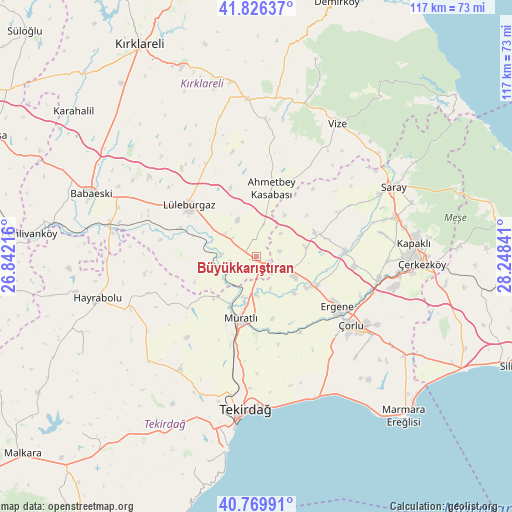
| Upper-left | 41.82637°, | 26.84216° |
| Center: | 41.30028°, | 27.54528° |
| Lower-right: | 40.76991°, | 28.24841° |
| Map W x H: | 117.5×117.5 km | = 73×73mi |
| max Lat: | 42.02683° ⇑4.3% North |
| Büyükkarıştıran: | 41.30028° |
| min Lat: | ⇓95.7% South 35.9025° |
| min Long | Büyükkarışt | max Long |
| 25.90902° | 27.54528° | 44.60099° |
| W 6.6%⇐ | ⇒93.4% E |
Elevation
Elevation of Büyükkarıştıran is 76 m = 249 ft, and this is 641.4 m = 2104 ft below average elevation for this country.
| Max E: |
2682 m = 8799 ft | 84.4% |
| Avg. | 717.4 m = 2354 ft | |
| Büyükkarıştıran | 76 m = 249 ft | |
Min E: |
0 m = 0 ft | 15.6% |
See also: Turkey elevation on elevation.city.
Geographical zone
Büyükkarıştıran is located in North temperate zone (between Tropic of Cancer and the Arctic Circle). Distance of this Northern Tropic circle is 1986.2 km =1234.2 mi to South.| Distance of | km | miles | from Büyükkarıştıran |
|---|---|---|---|
| North Pole | 5414.9 | 3364.7 | to North |
| Arctic Circle | 2809 | 1745.4 | to North |
| Tropic Cancer | 1986.2 | 1234.2 | to South |
| Equator | 4592.2 | 2853.5 | to South |


Nearby cities:
15 places around Büyükkarıştıran: (largest is in red/bold)
• Banarlı
31.3 km =19.4 mi,  214°
214°
• Beyazköy
14.3 km =8.9 mi,  68°
68°
• Dambaslar
26.2 km =16.3 mi,  251°
251°
• Hayrabolu
37.9 km =23.5 mi,  255°
255°
• Kapaklı
36.5 km =22.7 mi,  84°
84°
• Lüleburgaz
19.3 km =12 mi,  306°
306°
• Marmaracık
20.3 km =12.6 mi,  120°
120°
• Muratlı
14.8 km =9.2 mi,  195°
195°
• Pınarhisar
36.1 km =22.4 mi,  356°
356°
• Saray
35.3 km =21.9 mi,  62°
62°
• Tekirdağ
35.9 km =22.3 mi,  184°
184°
• Velimeşe
28.3 km =17.6 mi,  100°
100°
• Vize
35.4 km =22 mi,  31°
31°
• Çerkezköy
38 km =23.6 mi,  92°
92°
• Çorlu
26.5 km =16.5 mi,  126°
126°
Sources, notices
• [Note1] Compared only with cities in Turkey existing in our database
• [Src1] Map data: © OpenStreetMap contributors (CC-BY-SA)
• [Src2] Other city data from geonames.org with taken over terms of usage.
• [Src3] Geographical zone / Annual Mean Temperature by Robert A. Rohde @ Wikipedia
