Şenpazar geodata
Şenpazar (Kastamonu) is a seat of a second-order administrative division; located in Turkey in Europe/Istanbul (GMT+3) time zone. In our database, there are 1323 cities with bigger population. Compared to other cities in Turkey, 99.1% of cities are located further ↓South; 61.4% of cities are located further →East and 67.1% of cities have higher elevation than Şenpazar. Note1


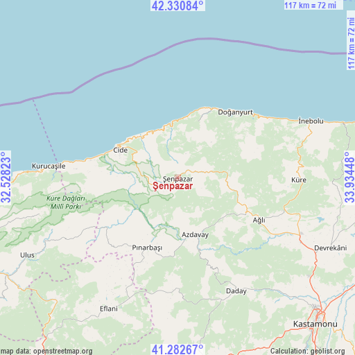
Şenpazar GPS coordinates[2]
41° 48' 32.04" North, 33° 13' 52.86" East
| Map corner | latitude | longitude |
|---|---|---|
| Upper-left | 42.33084°, | 32.52823° |
| Center: | 41.8089°, | 33.23135° |
| Lower-right: | 41.28267°, | 33.93448° |
| Map W x H: | 116.5×116.5 km | = 72.4×72.4mi |
| max Lat: | 42.02683° ⇑0.9% North |
| Şenpazar: | 41.8089° |
| min Lat: | ⇓99.1% South 35.9025° |
| min Long | Şenpazar | max Long |
| 25.90902° | 33.23135° | 44.60099° |
| W 38.6%⇐ | ⇒61.4% E |
Elevation
Elevation of Şenpazar is 374 m = 1227 ft, and this is 343.4 m = 1127 ft below average elevation for this country.
| Max E: |
2682 m = 8799 ft | 67.1% |
| Avg. | 717.4 m = 2354 ft | |
| Şenpazar | 374 m = 1227 ft | |
Min E: |
0 m = 0 ft | 32.9% |
See also: Turkey elevation on elevation.city.
Geographical zone
Şenpazar is located in North temperate zone (between Tropic of Cancer and the Arctic Circle). Distance of this Northern Tropic circle is 2042.8 km =1269.3 mi to South.| Distance of | km | miles | from Şenpazar |
|---|---|---|---|
| North Pole | 5358.3 | 3329.5 | to North |
| Arctic Circle | 2752.5 | 1710.3 | to North |
| Tropic Cancer | 2042.8 | 1269.3 | to South |
| Equator | 4648.7 | 2888.6 | to South |


Nearby cities:
15 places around Şenpazar: (largest is in red/bold)
• Arıt
52.2 km =32.4 mi,  254°
254°
• Azdavay
19.3 km =12 mi,  162°
162°
• Ağlı
30 km =18.6 mi,  117°
117°
• Cide
21 km =13 mi,  296°
296°
• Daday
41.6 km =25.8 mi,  151°
151°
• Devrekani
55.4 km =34.4 mi,  114°
114°
• Doğanyurt
28.8 km =17.9 mi,  41°
41°
• Eflani
48.6 km =30.2 mi,  207°
207°
• Kurucaşile
42.8 km =26.6 mi,  274°
274°
• Küre
39.8 km =24.7 mi,  90°
90°
• Ovacuma
56.4 km =35 mi,  224°
224°
• Pınarbaşı
24.9 km =15.5 mi,  203°
203°
• Seydiler
45.5 km =28.3 mi, 117°
• Ulus
55 km =34.2 mi,  242°
242°
• İnebolu
47.5 km =29.5 mi,  67°
67°
Sources, notices
• [Note1] Compared only with cities in Turkey existing in our database
• [Src1] Map data: © OpenStreetMap contributors (CC-BY-SA)
• [Src2] Other city data from geonames.org with taken over terms of usage.
• [Src3] Geographical zone / Annual Mean Temperature by Robert A. Rohde @ Wikipedia
