Peçenek geodata
Peçenek (Ankara) is a seat of a third-order administrative division; located in Turkey in Europe/Istanbul (GMT+3) time zone. In our database, there are 1323 cities with bigger population. Compared to other cities in Turkey, 76.5% of cities are located further ↓South; 65.4% of cities are located further →East and 71.1% of cities have lower elevation than Peçenek. Note1


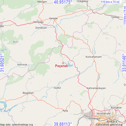
Peçenek GPS coordinates[2]
40° 25' 6.852" North, 32° 18' 29.988" East
| Map corner | latitude | longitude |
|---|---|---|
| Upper-left | 40.95175°, | 31.60521° |
| Center: | 40.41857°, | 32.30833° |
| Lower-right: | 39.88113°, | 33.01146° |
| Map W x H: | 119×119 km | = 73.9×73.9mi |
| max Lat: | 42.02683° ⇑23.5% North |
| Peçenek: | 40.41857° |
| min Lat: | ⇓76.5% South 35.9025° |
| min Long | Peçenek | max Long |
| 25.90902° | 32.30833° | 44.60099° |
| W 34.6%⇐ | ⇒65.4% E |
Elevation
Elevation of Peçenek is 1041 m = 3415 ft, and this is 323.6 m = 1062 ft above average elevation for this country.
| Max E: |
2682 m = 8799 ft | 28.9% |
| Peçenek | 1041 m 3415 ft | |
| Avg. | 717.4 m = 2354 ft | |
Min E: |
0 m = 0 ft | 71.1% |
See also: Turkey elevation on elevation.city.
Geographical zone
Peçenek is located in North temperate zone (between Tropic of Cancer and the Arctic Circle). Distance of this Northern Tropic circle is 1888.2 km =1173.3 mi to South.| Distance of | km | miles | from Peçenek |
|---|---|---|---|
| North Pole | 5512.9 | 3425.6 | to North |
| Arctic Circle | 2907.1 | 1806.4 | to North |
| Tropic Cancer | 1888.2 | 1173.3 | to South |
| Equator | 4494.1 | 2792.5 | to South |


Nearby cities:
15 places around Peçenek: (largest is in red/bold)
• Ayaş
44.4 km =27.6 mi,  177°
177°
• Beypazarı
43.1 km =26.8 mi,  229°
229°
• Dörtdivan
39.4 km =24.5 mi,  328°
328°
• Gerede
43.5 km =27 mi,  347°
347°
• Güdül
23.7 km =14.7 mi,  192°
192°
• Güvem
35.4 km =22 mi,  57°
57°
• Karaşar
29.1 km =18.1 mi,  249°
249°
• Kazan
38 km =23.6 mi,  123°
123°
• Kıbrıscık
38.7 km =24 mi,  268°
268°
• Kızılcahamam
29.5 km =18.3 mi,  78°
78°
• Pazar
38.5 km =23.9 mi,  104°
104°
• Uruş
23.8 km =14.8 mi,  217°
217°
• Yeniçağa
45.5 km =28.3 mi, 329°
• Çamlıdere
16.2 km =10.1 mi, 60°
• Çeltikçi
16.5 km =10.3 mi,  130°
130°
Sources, notices
• [Note1] Compared only with cities in Turkey existing in our database
• [Src1] Map data: © OpenStreetMap contributors (CC-BY-SA)
• [Src2] Other city data from geonames.org with taken over terms of usage.
• [Src3] Geographical zone / Annual Mean Temperature by Robert A. Rohde @ Wikipedia
