Güdül geodata
Güdül (Ankara) is a populated place; located in Turkey in Europe/Istanbul (GMT+3) time zone. With population of 5,929 people, there are 661 cities with bigger population in this country. Compared to other cities in Turkey, 72.8% of cities are located further ↓South; 65.5% of cities are located further →East and 51.9% of cities have lower elevation than Güdül. Note1


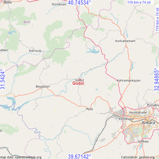
Güdül GPS coordinates[2]
40° 12' 37.836" North, 32° 14' 43.872" East
| Map corner | latitude | longitude |
|---|---|---|
| Upper-left | 40.74534°, | 31.5424° |
| Center: | 40.21051°, | 32.24552° |
| Lower-right: | 39.67142°, | 32.94865° |
| Map W x H: | 119.4×119.4 km | = 74.2×74.2mi |
| max Lat: | 42.02683° ⇑27.2% North |
| Güdül: | 40.21051° |
| min Lat: | ⇓72.8% South 35.9025° |
| min Long | Güdül | max Long |
| 25.90902° | 32.24552° | 44.60099° |
| W 34.5%⇐ | ⇒65.5% E |
Elevation
Elevation of Güdül is 738 m = 2421 ft, and this is 20.6 m = 68 ft above average elevation for this country.
| Max E: |
2682 m = 8799 ft | 48.1% |
| Güdül | 738 m 2421 ft | |
| Avg. | 717.4 m = 2354 ft | |
Min E: |
0 m = 0 ft | 51.9% |
See also: Turkey elevation on elevation.city.
Geographical zone
Güdül is located in North temperate zone (between Tropic of Cancer and the Arctic Circle). Distance of this Northern Tropic circle is 1865.1 km =1158.9 mi to South.| Distance of | km | miles | from Güdül |
|---|---|---|---|
| North Pole | 5536.1 | 3440 | to North |
| Arctic Circle | 2930.2 | 1820.7 | to North |
| Tropic Cancer | 1865.1 | 1158.9 | to South |
| Equator | 4471 | 2778.1 | to South |


Nearby cities:
15 places around Güdül: (largest is in red/bold)
• Ayaş
22.5 km =14 mi,  160°
160°
• Batikent
49.3 km =30.6 mi,  123°
123°
• Beypazarı
28 km =17.4 mi,  260°
260°
• Etimesgut
43.6 km =27.1 mi,  130°
130°
• Gelegra
41.4 km =25.7 mi,  238°
238°
• Karaşar
25.4 km =15.8 mi,  300°
300°
• Kazan
37.3 km =23.2 mi,  86°
86°
• Kıbrıscık
39.9 km =24.8 mi, 303°
• Kızılcahamam
44.8 km =27.8 mi,  49°
49°
• Pazar
44.7 km =27.8 mi,  72°
72°
• Peçenek
23.7 km =14.7 mi,  12°
12°
• Uruş
10.1 km =6.3 mi, 295°
• Çamlıdere
36.6 km =22.7 mi,  32°
32°
• Çayırhan
50.2 km =31.2 mi, 255°
• Çeltikçi
21.7 km =13.5 mi,  55°
55°
Sources, notices
• [Note1] Compared only with cities in Turkey existing in our database
• [Src1] Map data: © OpenStreetMap contributors (CC-BY-SA)
• [Src2] Other city data from geonames.org with taken over terms of usage.
• [Src3] Geographical zone / Annual Mean Temperature by Robert A. Rohde @ Wikipedia
