Ortaköy geodata
Ortaköy (Artvin) is a seat of a third-order administrative division; located in Turkey in Europe/Istanbul (GMT+3) time zone. In our database, there are 1323 cities with bigger population. Compared to other cities in Turkey, 95.1% of cities are located further ↓South; 90.3% of cities are located further ←West and 60.2% of cities have lower elevation than Ortaköy. Note1


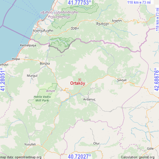
Ortaköy GPS coordinates[2]
41° 15' 3.744" North, 41° 59' 1.068" East
| Map corner | latitude | longitude |
|---|---|---|
| Upper-left | 41.77753°, | 41.28051° |
| Center: | 41.25104°, | 41.98363° |
| Lower-right: | 40.72027°, | 42.68676° |
| Map W x H: | 117.6×117.6 km | = 73.1×73.1mi |
| max Lat: | 42.02683° ⇑4.9% North |
| Ortaköy: | 41.25104° |
| min Lat: | ⇓95.1% South 35.9025° |
| min Long | Ortaköy | max Long |
| 25.90902° | 41.98363° | 44.60099° |
| W 90.3%⇐ | ⇒9.7% E |
Elevation
Elevation of Ortaköy is 887 m = 2910 ft, and this is 169.6 m = 556 ft above average elevation for this country.
| Max E: |
2682 m = 8799 ft | 39.8% |
| Ortaköy | 887 m 2910 ft | |
| Avg. | 717.4 m = 2354 ft | |
Min E: |
0 m = 0 ft | 60.2% |
See also: Turkey elevation on elevation.city.
Geographical zone
Ortaköy is located in North temperate zone (between Tropic of Cancer and the Arctic Circle). Distance of this Northern Tropic circle is 1980.8 km =1230.8 mi to South.| Distance of | km | miles | from Ortaköy |
|---|---|---|---|
| North Pole | 5420.4 | 3368.1 | to North |
| Arctic Circle | 2814.5 | 1748.8 | to North |
| Tropic Cancer | 1980.8 | 1230.8 | to South |
| Equator | 4586.7 | 2850 | to South |


Nearby cities:
15 places around Ortaköy: (largest is in red/bold)
• Ardanuç
15.3 km =9.5 mi,  154°
154°
• Artvin
15.6 km =9.7 mi,  240°
240°
• Aşağı Irmaklar
17.7 km =11 mi,  115°
115°
• Borçka
29.1 km =18.1 mi,  294°
294°
• Camili
26.3 km =16.3 mi,  344°
344°
• Demirkent
46.5 km =28.9 mi,  207°
207°
• Kemalpaşa
46 km =28.6 mi,  304°
304°
• Meydancık
27.5 km =17.1 mi,  50°
50°
• Muratlı
33.9 km =21.1 mi,  316°
316°
• Murgul
36 km =22.4 mi,  275°
275°
• Seyitler
13.8 km =8.6 mi, 243°
• Veliköy
38.2 km =23.7 mi,  79°
79°
• Zeytinlik
18.9 km =11.7 mi, 213°
• Öğdem
47.2 km =29.3 mi,  218°
218°
• Şavşat
31.6 km =19.6 mi,  92°
92°
Sources, notices
• [Note1] Compared only with cities in Turkey existing in our database
• [Src1] Map data: © OpenStreetMap contributors (CC-BY-SA)
• [Src2] Other city data from geonames.org with taken over terms of usage.
• [Src3] Geographical zone / Annual Mean Temperature by Robert A. Rohde @ Wikipedia
