Çatalzeytin geodata
Çatalzeytin (Kastamonu) is a seat of a second-order administrative division; located in Turkey in Europe/Istanbul (GMT+3) time zone. In our database, there are 1323 cities with bigger population. Compared to other cities in Turkey, 99.8% of cities are located further ↓South; 57.7% of cities are located further →East and 95.5% of cities have higher elevation than Çatalzeytin. Note1


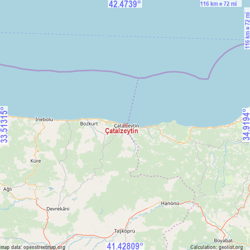
Çatalzeytin GPS coordinates[2]
41° 57' 11.304" North, 34° 12' 58.572" East
| Map corner | latitude | longitude |
|---|---|---|
| Upper-left | 42.4739°, | 33.51315° |
| Center: | 41.95314°, | 34.21627° |
| Lower-right: | 41.42809°, | 34.9194° |
| Map W x H: | 116.3×116.3 km | = 72.3×72.3mi |
| max Lat: | 42.02683° ⇑0.2% North |
| Çatalzeytin: | 41.95314° |
| min Lat: | ⇓99.8% South 35.9025° |
| min Long | Çatalzeytin | max Long |
| 25.90902° | 34.21627° | 44.60099° |
| W 42.3%⇐ | ⇒57.7% E |
Elevation
Elevation of Çatalzeytin is 15 m = 49 ft, and this is 702.4 m = 2304 ft below average elevation for this country.
| Max E: |
2682 m = 8799 ft | 95.5% |
| Avg. | 717.4 m = 2354 ft | |
| Çatalzeytin | 15 m = 49 ft | |
Min E: |
0 m = 0 ft | 4.5% |
See also: Turkey elevation on elevation.city.
Geographical zone
Çatalzeytin is located in North temperate zone (between Tropic of Cancer and the Arctic Circle). Distance of this Northern Tropic circle is 2058.8 km =1279.3 mi to South.| Distance of | km | miles | from Çatalzeytin |
|---|---|---|---|
| North Pole | 5342.3 | 3319.6 | to North |
| Arctic Circle | 2736.4 | 1700.3 | to North |
| Tropic Cancer | 2058.8 | 1279.3 | to South |
| Equator | 4664.8 | 2898.6 | to South |


Nearby cities:
15 places around Çatalzeytin: (largest is in red/bold)
• Abana
17.2 km =10.7 mi,  279°
279°
• Ayancık
30.6 km =19 mi,  91°
91°
• Ağlı
62.4 km =38.8 mi,  241°
241°
• Bozkurt
17 km =10.6 mi,  271°
271°
• Devrekani
49.9 km =31 mi,  218°
218°
• Doğanyurt
62.7 km =39 mi, 275°
• Erfelek
58.7 km =36.5 mi,  98°
98°
• Güzelkent
14.7 km =9.1 mi, 92°
• Hanönü
41.8 km =26 mi,  150°
150°
• Küre
44.9 km =27.9 mi,  248°
248°
• Seydiler
55.5 km =34.5 mi,  228°
228°
• Taşköprü
49.3 km =30.6 mi,  180°
180°
• Türkeli
10.1 km =6.3 mi, 93°
• Yenikonak
33.2 km =20.6 mi,  105°
105°
• İnebolu
37.7 km =23.4 mi, 273°
Sources, notices
• [Note1] Compared only with cities in Turkey existing in our database
• [Src1] Map data: © OpenStreetMap contributors (CC-BY-SA)
• [Src2] Other city data from geonames.org with taken over terms of usage.
• [Src3] Geographical zone / Annual Mean Temperature by Robert A. Rohde @ Wikipedia
