Khanjarah geodata
Khanjarah (Çankırı) is a seat of a first-order administrative division; located in Turkey in Europe/Istanbul (GMT+3) time zone. With population of 71,379 people, there are 128 cities with bigger population in this country. Compared to other cities in Turkey, 79% of cities are located further ↓South; 59.8% of cities are located further →East and 51.5% of cities have lower elevation than Khanjarah. Note1


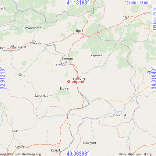
Khanjarah GPS coordinates[2]
40° 35' 59.82" North, 33° 36' 55.08" East
| Map corner | latitude | longitude |
|---|---|---|
| Upper-left | 41.13168°, | 32.91218° |
| Center: | 40.59995°, | 33.6153° |
| Lower-right: | 40.06396°, | 34.31843° |
| Map W x H: | 118.7×118.7 km | = 73.8×73.8mi |
| max Lat: | 42.02683° ⇑21% North |
| Khanjarah: | 40.59995° |
| min Lat: | ⇓79% South 35.9025° |
| min Long | Khanjarah | max Long |
| 25.90902° | 33.6153° | 44.60099° |
| W 40.2%⇐ | ⇒59.8% E |
Elevation
Elevation of Khanjarah is 727 m = 2385 ft, and this is 9.6 m = 31 ft above average elevation for this country.
| Max E: |
2682 m = 8799 ft | 48.5% |
| Khanjarah | 727 m 2385 ft | |
| Avg. | 717.4 m = 2354 ft | |
Min E: |
0 m = 0 ft | 51.5% |
See also: Khanjarah elevation on elevation.city.
Geographical zone
Khanjarah is located in North temperate zone (between Tropic of Cancer and the Arctic Circle). Distance of this Northern Tropic circle is 1908.4 km =1185.8 mi to South.| Distance of | km | miles | from Khanjarah |
|---|---|---|---|
| North Pole | 5492.8 | 3413.1 | to North |
| Arctic Circle | 2886.9 | 1793.8 | to North |
| Tropic Cancer | 1908.4 | 1185.8 | to South |
| Equator | 4514.3 | 2805.1 | to South |


Nearby cities:
15 places around Khanjarah: (largest is in red/bold)
• Atkaracalar
51.4 km =31.9 mi,  297°
297°
• Bayramören
51.6 km =32.1 mi,  317°
317°
• Belören
30.8 km =19.1 mi,  340°
340°
• Eldivan
12.5 km =7.8 mi,  231°
231°
• Hasayaz
46.8 km =29.1 mi,  211°
211°
• Ilgaz
36.2 km =22.5 mi,  1°
1°
• Korgun
17.1 km =10.6 mi,  331°
331°
• Kurşunlu
40.2 km =25 mi,  311°
311°
• Kızılırmak
42.3 km =26.3 mi,  132°
132°
• Orta
42.8 km =26.6 mi,  273°
273°
• Sulakyurt
49.9 km =31 mi,  170°
170°
• Yapraklı
22.3 km =13.9 mi,  38°
38°
• Çandır
40.1 km =24.9 mi,  198°
198°
• İkizören
24.7 km =15.3 mi,  66°
66°
• Şabanözü
30.9 km =19.2 mi,  245°
245°
Sources, notices
• [Note1] Compared only with cities in Turkey existing in our database
• [Src1] Map data: © OpenStreetMap contributors (CC-BY-SA)
• [Src2] Other city data from geonames.org with taken over terms of usage.
• [Src3] Geographical zone / Annual Mean Temperature by Robert A. Rohde @ Wikipedia
