İkizören geodata
İkizören (Çankırı) is a seat of a third-order administrative division; located in Turkey in Europe/Istanbul (GMT+3) time zone. In our database, there are 1323 cities with bigger population. Compared to other cities in Turkey, 80.8% of cities are located further ↓South; 58.7% of cities are located further →East and 80% of cities have lower elevation than İkizören. Note1


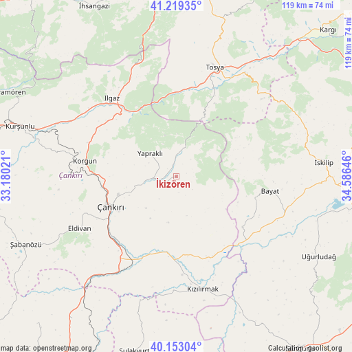
İkizören GPS coordinates[2]
40° 41' 17.988" North, 33° 52' 59.988" East
| Map corner | latitude | longitude |
|---|---|---|
| Upper-left | 41.21935°, | 33.18021° |
| Center: | 40.68833°, | 33.88333° |
| Lower-right: | 40.15304°, | 34.58646° |
| Map W x H: | 118.6×118.6 km | = 73.7×73.7mi |
| max Lat: | 42.02683° ⇑19.2% North |
| İkizören: | 40.68833° |
| min Lat: | ⇓80.8% South 35.9025° |
| min Long | İkizören | max Long |
| 25.90902° | 33.88333° | 44.60099° |
| W 41.3%⇐ | ⇒58.7% E |
Elevation
Elevation of İkizören is 1194 m = 3917 ft, and this is 476.6 m = 1564 ft above average elevation for this country.
| Max E: |
2682 m = 8799 ft | 20% |
| İkizören | 1194 m 3917 ft | |
| Avg. | 717.4 m = 2354 ft | |
Min E: |
0 m = 0 ft | 80% |
See also: Turkey elevation on elevation.city.
Geographical zone
İkizören is located in North temperate zone (between Tropic of Cancer and the Arctic Circle). Distance of this Northern Tropic circle is 1918.2 km =1191.9 mi to South.| Distance of | km | miles | from İkizören |
|---|---|---|---|
| North Pole | 5482.9 | 3406.9 | to North |
| Arctic Circle | 2877.1 | 1787.7 | to North |
| Tropic Cancer | 1918.2 | 1191.9 | to South |
| Equator | 4524.1 | 2811.1 | to South |


Nearby cities:
15 places around İkizören: (largest is in red/bold)
• Bayat
32.2 km =20 mi,  98°
98°
• Belören
37.9 km =23.5 mi,  300°
300°
• Eldivan
36.9 km =22.9 mi,  241°
241°
• Ilgaz
34.1 km =21.2 mi,  320°
320°
• Khanjarah
24.7 km =15.3 mi,  246°
246°
• Korgun
31.2 km =19.4 mi,  279°
279°
• Kurşunlu
55.1 km =34.2 mi,  287°
287°
• Kızılırmak
39.1 km =24.3 mi,  167°
167°
• Sulakyurt
60.7 km =37.7 mi,  193°
193°
• Tosya
38.7 km =24 mi,  19°
19°
• Uğurludağ
55.1 km =34.2 mi,  119°
119°
• Yapraklı
11.8 km =7.3 mi,  311°
311°
• Çandır
59.4 km =36.9 mi,  216°
216°
• İskilip
50 km =31.1 mi,  84°
84°
• Şabanözü
55.6 km =34.5 mi, 245°
Sources, notices
• [Note1] Compared only with cities in Turkey existing in our database
• [Src1] Map data: © OpenStreetMap contributors (CC-BY-SA)
• [Src2] Other city data from geonames.org with taken over terms of usage.
• [Src3] Geographical zone / Annual Mean Temperature by Robert A. Rohde @ Wikipedia
