Çamlıbel geodata
Çamlıbel (Tokat) is a seat of a third-order administrative division; located in Turkey in Europe/Istanbul (GMT+3) time zone. In our database, there are 1323 cities with bigger population. Compared to other cities in Turkey, 70.6% of cities are located further ↓South; 54.6% of cities are located further ←West and 76.2% of cities have lower elevation than Çamlıbel. Note1


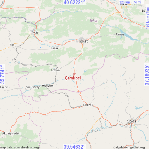
Çamlıbel GPS coordinates[2]
40° 5' 11.004" North, 36° 28' 37.992" East
| Map corner | latitude | longitude |
|---|---|---|
| Upper-left | 40.62221°, | 35.7741° |
| Center: | 40.08639°, | 36.47722° |
| Lower-right: | 39.54632°, | 37.18035° |
| Map W x H: | 119.6×119.6 km | = 74.3×74.3mi |
| max Lat: | 42.02683° ⇑29.4% North |
| Çamlıbel: | 40.08639° |
| min Lat: | ⇓70.6% South 35.9025° |
| min Long | Çamlıbel | max Long |
| 25.90902° | 36.47722° | 44.60099° |
| W 54.6%⇐ | ⇒45.4% E |
Elevation
Elevation of Çamlıbel is 1125 m = 3691 ft, and this is 407.6 m = 1337 ft above average elevation for this country.
| Max E: |
2682 m = 8799 ft | 23.8% |
| Çamlıbel | 1125 m 3691 ft | |
| Avg. | 717.4 m = 2354 ft | |
Min E: |
0 m = 0 ft | 76.2% |
See also: Turkey elevation on elevation.city.
Geographical zone
Çamlıbel is located in North temperate zone (between Tropic of Cancer and the Arctic Circle). Distance of this Northern Tropic circle is 1851.3 km =1150.3 mi to South.| Distance of | km | miles | from Çamlıbel |
|---|---|---|---|
| North Pole | 5549.9 | 3448.5 | to North |
| Arctic Circle | 2944 | 1829.3 | to North |
| Tropic Cancer | 1851.3 | 1150.3 | to South |
| Equator | 4457.2 | 2769.6 | to South |


Nearby cities:
15 places around Çamlıbel: (largest is in red/bold)
• Almus
48.5 km =30.1 mi,  48°
48°
• Artova
15.4 km =9.6 mi,  282°
282°
• Boztepe
51.4 km =31.9 mi, 282°
• Direkli
44.2 km =27.5 mi,  160°
160°
• Dökmetepe
29.6 km =18.4 mi,  327°
327°
• Gökdere
48.9 km =30.4 mi,  28°
28°
• Pazar
26.8 km =16.7 mi,  322°
322°
• Sulusaray
35 km =21.7 mi,  252°
252°
• Tokat
26.1 km =16.2 mi,  14°
14°
• Turhal
47.4 km =29.5 mi,  314°
314°
• Yavu
40.1 km =24.9 mi,  215°
215°
• Yeşilyurt
23.6 km =14.7 mi, 247°
• Yeşilyurt
28.9 km =18 mi,  338°
338°
• Yıldızeli
26.6 km =16.5 mi, 157°
• Çırçır
25.6 km =15.9 mi,  97°
97°
Sources, notices
• [Note1] Compared only with cities in Turkey existing in our database
• [Src1] Map data: © OpenStreetMap contributors (CC-BY-SA)
• [Src2] Other city data from geonames.org with taken over terms of usage.
• [Src3] Geographical zone / Annual Mean Temperature by Robert A. Rohde @ Wikipedia
