Yavu geodata
Yavu (Sivas) is a seat of a third-order administrative division; located in Turkey in Europe/Istanbul (GMT+3) time zone. In our database, there are 1323 cities with bigger population. Compared to other cities in Turkey, 65.5% of cities are located further ↓South; 52.3% of cities are located further ←West and 80.2% of cities have lower elevation than Yavu. Note1


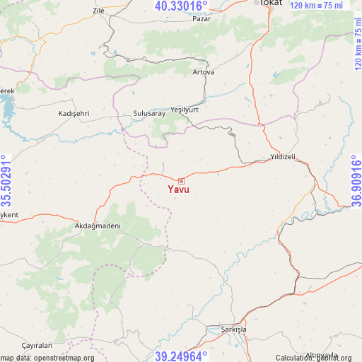
Yavu GPS coordinates[2]
39° 47' 31.272" North, 36° 12' 21.708" East
| Map corner | latitude | longitude |
|---|---|---|
| Upper-left | 40.33016°, | 35.50291° |
| Center: | 39.79202°, | 36.20603° |
| Lower-right: | 39.24964°, | 36.90916° |
| Map W x H: | 120.1×120.1 km | = 74.6×74.6mi |
| max Lat: | 42.02683° ⇑34.5% North |
| Yavu: | 39.79202° |
| min Lat: | ⇓65.5% South 35.9025° |
| min Long | Yavu | max Long |
| 25.90902° | 36.20603° | 44.60099° |
| W 52.3%⇐ | ⇒47.7% E |
Elevation
Elevation of Yavu is 1199 m = 3934 ft, and this is 481.6 m = 1580 ft above average elevation for this country.
| Max E: |
2682 m = 8799 ft | 19.8% |
| Yavu | 1199 m 3934 ft | |
| Avg. | 717.4 m = 2354 ft | |
Min E: |
0 m = 0 ft | 80.2% |
See also: Turkey elevation on elevation.city.
Geographical zone
Yavu is located in North temperate zone (between Tropic of Cancer and the Arctic Circle). Distance of this Northern Tropic circle is 1818.5 km =1130 mi to South.| Distance of | km | miles | from Yavu |
|---|---|---|---|
| North Pole | 5582.6 | 3468.9 | to North |
| Arctic Circle | 2976.7 | 1849.6 | to North |
| Tropic Cancer | 1818.5 | 1130 | to South |
| Equator | 4424.5 | 2749.3 | to South |


Nearby cities:
15 places around Yavu: (largest is in red/bold)
• Akcakışla
30.3 km =18.8 mi,  158°
158°
• Akdağmadeni
31.2 km =19.4 mi,  242°
242°
• Artova
36.9 km =22.9 mi,  12°
12°
• Bedirli
42.4 km =26.3 mi,  123°
123°
• Boztepe
51.7 km =32.1 mi,  328°
328°
• Direkli
39.1 km =24.3 mi,  103°
103°
• Kadışehri
42 km =26.1 mi,  302°
302°
• Kayadibi
55.5 km =34.5 mi,  128°
128°
• Ortaköy
41.3 km =25.7 mi,  176°
176°
• Pazar
54.3 km =33.7 mi, 6°
• Sulusaray
24.7 km =15.3 mi,  335°
335°
• Yeşilyurt
23.9 km =14.9 mi,  3°
3°
• Yıldızeli
34.5 km =21.4 mi,  76°
76°
• Çamlıbel
40.1 km =24.9 mi,  35°
35°
• Şarkışla
52 km =32.3 mi, 160°
Sources, notices
• [Note1] Compared only with cities in Turkey existing in our database
• [Src1] Map data: © OpenStreetMap contributors (CC-BY-SA)
• [Src2] Other city data from geonames.org with taken over terms of usage.
• [Src3] Geographical zone / Annual Mean Temperature by Robert A. Rohde @ Wikipedia
