Çalı geodata
Çalı (Bursa) is a seat of a third-order administrative division; located in Turkey in Europe/Istanbul (GMT+3) time zone. In our database, there are 1323 cities with bigger population. Compared to other cities in Turkey, 72% of cities are located further ↓South; 84.4% of cities are located further →East and 78.5% of cities have higher elevation than Çalı. Note1


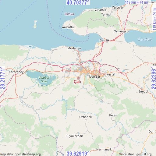
Çalı GPS coordinates[2]
40° 10' 6.996" North, 28° 55' 14.988" East
| Map corner | latitude | longitude |
|---|---|---|
| Upper-left | 40.70377°, | 28.21771° |
| Center: | 40.16861°, | 28.92083° |
| Lower-right: | 39.62919°, | 29.62396° |
| Map W x H: | 119.5×119.5 km | = 74.3×74.3mi |
| max Lat: | 42.02683° ⇑28% North |
| Çalı: | 40.16861° |
| min Lat: | ⇓72% South 35.9025° |
| min Long | Çalı | max Long |
| 25.90902° | 28.92083° | 44.60099° |
| W 15.6%⇐ | ⇒84.4% E |
Elevation
Elevation of Çalı is 131 m = 430 ft, and this is 586.4 m = 1924 ft below average elevation for this country.
| Max E: |
2682 m = 8799 ft | 78.5% |
| Avg. | 717.4 m = 2354 ft | |
| Çalı | 131 m = 430 ft | |
Min E: |
0 m = 0 ft | 21.5% |
See also: Turkey elevation on elevation.city.
Geographical zone
Çalı is located in North temperate zone (between Tropic of Cancer and the Arctic Circle). Distance of this Northern Tropic circle is 1860.4 km =1156 mi to South.| Distance of | km | miles | from Çalı |
|---|---|---|---|
| North Pole | 5540.7 | 3442.8 | to North |
| Arctic Circle | 2934.8 | 1823.6 | to North |
| Tropic Cancer | 1860.4 | 1156 | to South |
| Equator | 4466.3 | 2775.2 | to South |


Nearby cities:
15 places around Çalı: (largest is in red/bold)
• Bursa
12.2 km =7.6 mi,  75°
75°
• Demirtaş
19 km =11.8 mi,  52°
52°
• Görükle
9.8 km =6.1 mi,  315°
315°
• Gürsu
23.9 km =14.9 mi, 76°
• Karıncalı
22.6 km =14 mi,  193°
193°
• Kestel
25 km =15.5 mi, 82°
• Kirazlı
12.8 km =8 mi,  126°
126°
• Mahmudiye
29.7 km =18.5 mi,  309°
309°
• Mudanya
23.2 km =14.4 mi,  351°
351°
• Nilüfer
5.1 km =3.2 mi,  355°
355°
• Osmangazi
12.2 km =7.6 mi, 75°
• Seçköy
29.1 km =18.1 mi, 53°
• Soğukpınar
21.3 km =13.2 mi, 126°
• Yıldırım
16.2 km =10.1 mi, 82°
• Zeytinbağı
26.9 km =16.7 mi,  336°
336°
Sources, notices
• [Note1] Compared only with cities in Turkey existing in our database
• [Src1] Map data: © OpenStreetMap contributors (CC-BY-SA)
• [Src2] Other city data from geonames.org with taken over terms of usage.
• [Src3] Geographical zone / Annual Mean Temperature by Robert A. Rohde @ Wikipedia
