Donggang geodata
Donggang (Taiwan) is a populated place; located in Taiwan in Asia/Taipei (GMT+8) time zone. With population of 48,100 people, there are 17 cities with bigger population in this country. Compared to other cities in Taiwan, 97.3% of cities are located further ↑North; 73% of cities are located further →East and 100% of cities have higher elevation than Donggang. Note1
Administrative division(s):
- Level 1: Taiwan
- Level 2: Pingtung
- Level 3: Donggang Township
- Level 4: Zhongxing Village


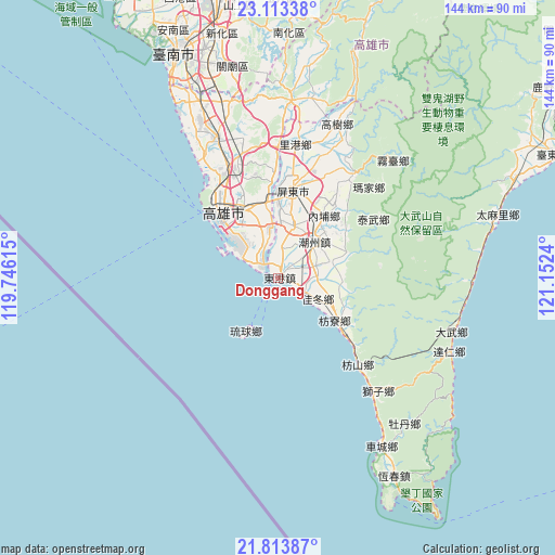
Donggang GPS coordinates[2]
22° 27' 54.54" North, 120° 26' 57.372" East
| Map corner | latitude | longitude |
|---|---|---|
| Upper-left | 23.11338°, | 119.74615° |
| Center: | 22.46515°, | 120.44927° |
| Lower-right: | 21.81387°, | 121.1524° |
| Map W x H: | 144.5×144.5 km | = 89.8×89.8mi |
| max Lat: | 26.15039° ⇑97.3% North |
| Donggang: | 22.46515° |
| min Lat: | ⇓2.7% South 22.00417° |
| min Long | Donggang | max Long |
| 118.31712° | 120.44927° | 121.84424° |
| W 27%⇐ | ⇒73% E |
Elevation
Elevation of Donggang is 8 m = 26 ft, and this is 70.5 m = 231 ft below average elevation for this country.
| Max E: |
505 m = 1657 ft | 100% |
| Avg. | 78.5 m = 258 ft | |
| Donggang | 8 m = 26 ft | |
Min E: |
8 m = 26 ft | 0% |
See also: Donggang elevation on elevation.city.
Geographical zone
Donggang is located in North Torrid zone (between Equator and Tropic of Cancer). Distance of this Northern Tropic circle is 108 km =67.1 mi to North.| Distance of | km | miles | from Donggang |
|---|---|---|---|
| North Pole | 7509.2 | 4666 | to North |
| Arctic Circle | 4903.3 | 3046.8 | to North |
| Tropic Cancer | 108 | 67.1 | to North |
| Equator | 2497.9 | 1552.1 | to South |


Nearby cities:
15 places around Donggang: (largest is in red/bold)
• Douliu
138.7 km =86.2 mi,  3°
3°
• Fengshan
20.1 km =12.5 mi,  333°
333°
• Hengchun
59.6 km =37 mi,  149°
149°
• Jiayi Shi
112.7 km =70 mi,  359°
359°
• Kaohsiung
21.8 km =13.5 mi,  320°
320°
• Lugu
145.8 km =90.6 mi,  12°
12°
• Magong
150.9 km =93.8 mi, 324°
• Pingtung
23.3 km =14.5 mi, 9°
• Pizitou
113.5 km =70.5 mi, 359°
• Taibao
111.2 km =69.1 mi,  353°
353°
• Tainan
63.3 km =39.3 mi,  337°
337°
• Taitung
78.5 km =48.8 mi,  65°
65°
• Taitung City
78.4 km =48.7 mi, 65°
• Xinying
94.7 km =58.8 mi, 351°
• Yujing
73.4 km =45.6 mi, 0°
Sources, notices
• [Note1] Compared only with cities in Taiwan existing in our database
• [Src1] Map data: © OpenStreetMap contributors (CC-BY-SA)
• [Src2] Other city data from geonames.org with taken over terms of usage.
• [Src3] Geographical zone / Annual Mean Temperature by Robert A. Rohde @ Wikipedia
