Muriti geodata
Muriti (Mara) is a populated place; located in Tanzania in Africa/Dar_es_Salaam (GMT+3) time zone. With population of 20,254 people, there are 119 cities with bigger population in this country. Compared to other cities in Tanzania, 93.7% of cities are located further ↓South; 81.1% of cities are located further →East and 50.7% of cities have lower elevation than Muriti. Note1


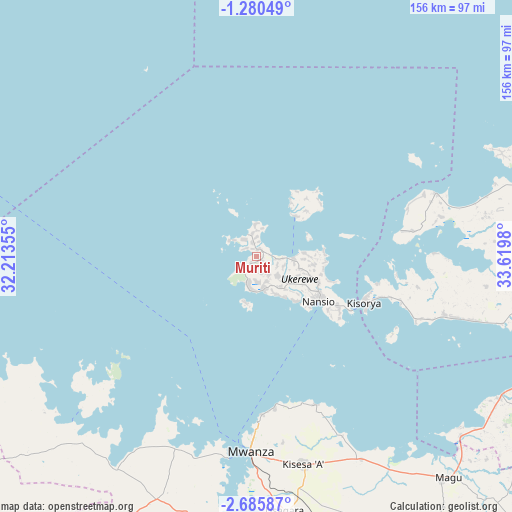
Muriti GPS coordinates[2]
1° 58' 59.988" South, 32° 55' 0.012" East
| Map corner | latitude | longitude |
|---|---|---|
| Upper-left | -1.28049°, | 32.21355° |
| Center: | -1.98333°, | 32.91667° |
| Lower-right: | -2.68587°, | 33.6198° |
| Map W x H: | 156.3×156.3 km | = 97.1×97.1mi |
| max Lat: | -1.14389° ⇑6.3% North |
| Muriti: | -1.98333° |
| min Lat: | ⇓93.7% South -11.36667° |
| min Long | Muriti | max Long |
| 29.62667° | 32.91667° | 40.33333° |
| W 18.9%⇐ | ⇒81.1% E |
Elevation
Elevation of Muriti is 1141 m = 3743 ft, and this is 198.2 m = 650 ft above average elevation for this country.
| Max E: |
2377 m = 7799 ft | 49.3% |
| Muriti | 1141 m 3743 ft | |
| Avg. | 942.8 m = 3093 ft | |
Min E: |
0 m = 0 ft | 50.7% |
See also: Tanzania elevation on elevation.city.
Geographical zone
Muriti is located in South Torrid zone (between Equator and Tropic of Capricorn). Distance of Equator is 220.5 km =137 mi to North.| Distance of | km | miles | from Muriti |
|---|---|---|---|
| Equator | 220.5 | 137 | to North |
| Tropic Capricorn | 2385.4 | 1482.2 | to South |
| Antarctic Circle | 7180.6 | 4461.8 | to South |
| South Pole | 9786.5 | 6081 | to South |


Nearby cities:
15 places around Muriti: (largest is in red/bold)
• Bukonyo
4.1 km =2.5 mi,  26°
26°
• Bunda
105.8 km =65.7 mi,  94°
94°
• Kasamwa
110.3 km =68.5 mi,  209°
209°
• Kibara
62.1 km =38.6 mi,  107°
107°
• Kihangara
82.3 km =51.1 mi,  144°
144°
• Misasi
114.5 km =71.1 mi,  170°
170°
• Misungwi
98.1 km =61 mi, 169°
• Mugango
93.2 km =57.9 mi,  69°
69°
• Musoma
111.9 km =69.5 mi,  61°
61°
• Mwanza
59.3 km =36.8 mi,  181°
181°
• Nakatunguru
22.3 km =13.9 mi,  131°
131°
• Nansio
22.3 km =13.9 mi, 138°
• Ngudu
118.7 km =73.8 mi,  157°
157°
• Nyanguge
70.4 km =43.7 mi,  153°
153°
• Usagara
78.4 km =48.7 mi, 173°
Sources, notices
• [Note1] Compared only with cities in Tanzania existing in our database
• [Src1] Map data: © OpenStreetMap contributors (CC-BY-SA)
• [Src2] Other city data from geonames.org with taken over terms of usage.
• [Src3] Geographical zone / Annual Mean Temperature by Robert A. Rohde @ Wikipedia
