Bunda geodata
Bunda (Mara) is a populated place; located in Tanzania in Africa/Dar_es_Salaam (GMT+3) time zone. With population of 50,944 people, there are 27 cities with bigger population in this country. Compared to other cities in Tanzania, 93% of cities are located further ↓South; 68.2% of cities are located further →East and 57.7% of cities have lower elevation than Bunda. Note1


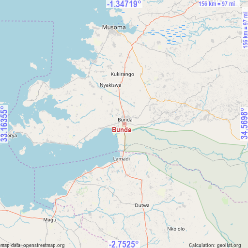
Bunda GPS coordinates[2]
2° 3' 0" South, 33° 52' 0.012" East
| Map corner | latitude | longitude |
|---|---|---|
| Upper-left | -1.34719°, | 33.16355° |
| Center: | -2.05°, | 33.86667° |
| Lower-right: | -2.7525°, | 34.5698° |
| Map W x H: | 156.3×156.3 km | = 97.1×97.1mi |
| max Lat: | -1.14389° ⇑7% North |
| Bunda: | -2.05° |
| min Lat: | ⇓93% South -11.36667° |
| min Long | Bunda | max Long |
| 29.62667° | 33.86667° | 40.33333° |
| W 31.8%⇐ | ⇒68.2% E |
Elevation
Elevation of Bunda is 1174 m = 3852 ft, and this is 231.2 m = 759 ft above average elevation for this country.
| Max E: |
2377 m = 7799 ft | 42.3% |
| Bunda | 1174 m 3852 ft | |
| Avg. | 942.8 m = 3093 ft | |
Min E: |
0 m = 0 ft | 57.7% |
See also: Bunda elevation on elevation.city.
Geographical zone
Bunda is located in South Torrid zone (between Equator and Tropic of Capricorn). Distance of Equator is 227.9 km =141.6 mi to North.| Distance of | km | miles | from Bunda |
|---|---|---|---|
| Equator | 227.9 | 141.6 | to North |
| Tropic Capricorn | 2378 | 1477.6 | to South |
| Antarctic Circle | 7173.2 | 4457.2 | to South |
| South Pole | 9779.1 | 6076.4 | to South |


Nearby cities:
15 places around Bunda: (largest is in red/bold)
• Bariadi
84.4 km =52.4 mi,  171°
171°
• Butiama
33.4 km =20.8 mi,  19°
19°
• Issenye
52.2 km =32.4 mi,  83°
83°
• Kibara
47.6 km =29.6 mi,  256°
256°
• Kihangara
82.5 km =51.3 mi,  224°
224°
• Maswa
71.6 km =44.5 mi, 169°
• Matonga
44.2 km =27.5 mi,  146°
146°
• Mugango
44.8 km =27.8 mi,  335°
335°
• Mugumu
95.2 km =59.2 mi, 76°
• Musoma
61.6 km =38.3 mi,  353°
353°
• Nakatunguru
89.2 km =55.4 mi,  265°
265°
• Nansio
91.2 km =56.7 mi, 264°
• Nyakabindi
66.1 km =41.1 mi, 168°
• Nyamuswa
23.6 km =14.7 mi,  44°
44°
• Nyanguge
92.6 km =57.5 mi,  233°
233°
Sources, notices
• [Note1] Compared only with cities in Tanzania existing in our database
• [Src1] Map data: © OpenStreetMap contributors (CC-BY-SA)
• [Src2] Other city data from geonames.org with taken over terms of usage.
• [Src3] Geographical zone / Annual Mean Temperature by Robert A. Rohde @ Wikipedia
