Mtambile geodata
Mtambile (Pemba South) is a populated place; located in Tanzania in Africa/Dar_es_Salaam (GMT+3) time zone. With population of 6,797 people, there are 264 cities with bigger population in this country. Compared to other cities in Tanzania, 51% of cities are located further ↑North; 96.9% of cities are located further ←West and 94.4% of cities have higher elevation than Mtambile. Note1


Mtambile GPS coordinates[2]
5° 22' 59.988" South, 39° 42' 0" East
| Map corner | latitude | longitude |
|---|---|---|
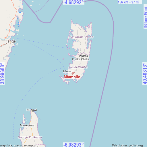
| Upper-left | -4.68292°, | 38.99688° |
| Center: | -5.38333°, | 39.7° |
| Lower-right: | -6.08293°, | 40.40313° |
| Map W x H: | 155.7×155.7 km | = 96.7×96.7mi |
| max Lat: | -1.14389° ⇑51% North |
| Mtambile: | -5.38333° |
| min Lat: | ⇓49% South -11.36667° |
| min Long | Mtambile | max Long |
| 29.62667° | 39.7° | 40.33333° |
| W 96.9%⇐ | ⇒3.1% E |
Elevation
Elevation of Mtambile is 23 m = 75 ft, and this is 919.8 m = 3018 ft below average elevation for this country.
| Max E: |
2377 m = 7799 ft | 94.4% |
| Avg. | 942.8 m = 3093 ft | |
| Mtambile | 23 m = 75 ft | |
Min E: |
0 m = 0 ft | 5.6% |
See also: Tanzania elevation on elevation.city.
Geographical zone
Mtambile is located in South Torrid zone (between Equator and Tropic of Capricorn). Distance of Equator is 598.6 km =372 mi to North.| Distance of | km | miles | from Mtambile |
|---|---|---|---|
| Equator | 598.6 | 372 | to North |
| Tropic Capricorn | 2007.3 | 1247.3 | to South |
| Antarctic Circle | 6802.6 | 4226.9 | to South |
| South Pole | 9408.5 | 5846.2 | to South |


Nearby cities:
15 places around Mtambile: (largest is in red/bold)
• Chake Chake
17 km =10.6 mi,  25°
25°
• Gamba
72.5 km =45 mi,  217°
217°
• Kijini
67 km =41.6 mi, 219°
• Kiwengwa
76.3 km =47.4 mi,  207°
207°
• Koani
95.3 km =59.2 mi, 208°
• Koani Ndogo
95.3 km =59.2 mi, 208°
• Konde
48.5 km =30.1 mi,  6°
6°
• Majengo
83.5 km =51.9 mi,  288°
288°
• Micheweni
48.6 km =30.2 mi,  17°
17°
• Mkokotoni
73.6 km =45.7 mi, 221°
• Nungwi
58.6 km =36.4 mi,  229°
229°
• Pangani
80.4 km =50 mi,  266°
266°
• Tanga
75.2 km =46.7 mi,  297°
297°
• Uwelini
2.6 km =1.6 mi, 224°
• Wete
36.6 km =22.7 mi, 5°
Sources, notices
• [Note1] Compared only with cities in Tanzania existing in our database
• [Src1] Map data: © OpenStreetMap contributors (CC-BY-SA)
• [Src2] Other city data from geonames.org with taken over terms of usage.
• [Src3] Geographical zone / Annual Mean Temperature by Robert A. Rohde @ Wikipedia
