Mkokotoni geodata
Mkokotoni (Zanzibar North) is a seat of a first-order administrative division; located in Tanzania in Africa/Dar_es_Salaam (GMT+3) time zone. With population of 2,572 people, there are 280 cities with bigger population in this country. Compared to other cities in Tanzania, 54.2% of cities are located further ↑North; 88.5% of cities are located further ←West and 99.7% of cities have higher elevation than Mkokotoni. Note1


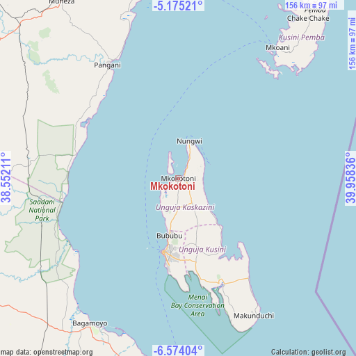
Mkokotoni GPS coordinates[2]
5° 52' 30.216" South, 39° 15' 18.828" East
| Map corner | latitude | longitude |
|---|---|---|
| Upper-left | -5.17521°, | 38.55211° |
| Center: | -5.87506°, | 39.25523° |
| Lower-right: | -6.57404°, | 39.95836° |
| Map W x H: | 155.5×155.5 km | = 96.6×96.6mi |
| max Lat: | -1.14389° ⇑54.2% North |
| Mkokotoni: | -5.87506° |
| min Lat: | ⇓45.8% South -11.36667° |
| min Long | Mkokotoni | max Long |
| 29.62667° | 39.25523° | 40.33333° |
| W 88.5%⇐ | ⇒11.5% E |
Elevation
Elevation of Mkokotoni is 5 m = 16 ft, and this is 937.8 m = 3077 ft below average elevation for this country.
| Max E: |
2377 m = 7799 ft | 99.7% |
| Avg. | 942.8 m = 3093 ft | |
| Mkokotoni | 5 m = 16 ft | |
Min E: |
0 m = 0 ft | 0.3% |
See also: Tanzania elevation on elevation.city.
Geographical zone
Mkokotoni is located in South Torrid zone (between Equator and Tropic of Capricorn). Distance of Equator is 653.2 km =405.9 mi to North.| Distance of | km | miles | from Mkokotoni |
|---|---|---|---|
| Equator | 653.2 | 405.9 | to North |
| Tropic Capricorn | 1952.7 | 1213.4 | to South |
| Antarctic Circle | 6747.9 | 4192.9 | to South |
| South Pole | 9353.8 | 5812.2 | to South |


Nearby cities:
15 places around Mkokotoni: (largest is in red/bold)
• Bagamoyo
74 km =46 mi,  211°
211°
• Gamba
5.7 km =3.5 mi,  119°
119°
• Kijini
7.3 km =4.5 mi,  67°
67°
• Kiwengwa
18.5 km =11.5 mi,  133°
133°
• Koani
28.9 km =18 mi,  173°
173°
• Koani Ndogo
28.9 km =18 mi, 173°
• Mahonda
68.1 km =42.3 mi,  159°
159°
• Mtambile
73.6 km =45.7 mi,  41°
41°
• Mvomero
77.3 km =48 mi,  237°
237°
• Nganane
66.8 km =41.5 mi,  150°
150°
• Nungwi
17.2 km =10.7 mi,  16°
16°
• Pangani
58.9 km =36.6 mi,  328°
328°
• Sokoni
70.1 km =43.6 mi, 152°
• Uwelini
71 km =44.1 mi, 41°
• Zanzibar
32.7 km =20.3 mi,  191°
191°
Sources, notices
• [Note1] Compared only with cities in Tanzania existing in our database
• [Src1] Map data: © OpenStreetMap contributors (CC-BY-SA)
• [Src2] Other city data from geonames.org with taken over terms of usage.
• [Src3] Geographical zone / Annual Mean Temperature by Robert A. Rohde @ Wikipedia
