Wete geodata
Wete (Pemba North) is a seat of a first-order administrative division; located in Tanzania in Africa/Dar_es_Salaam (GMT+3) time zone. With population of 26,450 people, there are 79 cities with bigger population in this country. Compared to other cities in Tanzania, 54.2% of cities are located further ↓South; 97.6% of cities are located further ←West and 89.2% of cities have higher elevation than Wete. Note1


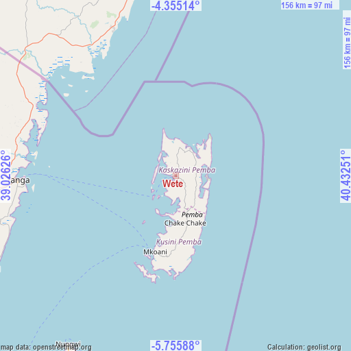
Wete GPS coordinates[2]
5° 3' 21.204" South, 39° 43' 45.768" East
| Map corner | latitude | longitude |
|---|---|---|
| Upper-left | -4.35514°, | 39.02626° |
| Center: | -5.05589°, | 39.72938° |
| Lower-right: | -5.75588°, | 40.43251° |
| Map W x H: | 155.7×155.8 km | = 96.7×96.8mi |
| max Lat: | -1.14389° ⇑45.8% North |
| Wete: | -5.05589° |
| min Lat: | ⇓54.2% South -11.36667° |
| min Long | Wete | max Long |
| 29.62667° | 39.72938° | 40.33333° |
| W 97.6%⇐ | ⇒2.4% E |
Elevation
Elevation of Wete is 53 m = 174 ft, and this is 889.8 m = 2919 ft below average elevation for this country.
| Max E: |
2377 m = 7799 ft | 89.2% |
| Avg. | 942.8 m = 3093 ft | |
| Wete | 53 m = 174 ft | |
Min E: |
0 m = 0 ft | 10.8% |
See also: Tanzania elevation on elevation.city.
Geographical zone
Wete is located in South Torrid zone (between Equator and Tropic of Capricorn). Distance of Equator is 562.2 km =349.3 mi to North.| Distance of | km | miles | from Wete |
|---|---|---|---|
| Equator | 562.2 | 349.3 | to North |
| Tropic Capricorn | 2043.8 | 1270 | to South |
| Antarctic Circle | 6839 | 4249.6 | to South |
| South Pole | 9444.9 | 5868.8 | to South |


Nearby cities:
15 places around Wete: (largest is in red/bold)
• Chake Chake
21.5 km =13.4 mi,  168°
168°
• Gamba
105.2 km =65.4 mi,  206°
206°
• Kijini
99.4 km =61.8 mi, 207°
• Kiwengwa
110.9 km =68.9 mi,  200°
200°
• Konde
12 km =7.5 mi,  10°
10°
• Majengo
83.3 km =51.8 mi,  262°
262°
• Micheweni
15.2 km =9.4 mi,  49°
49°
• Mkokotoni
105.1 km =65.3 mi, 209°
• Mlalo
89.2 km =55.4 mi,  278°
278°
• Mtambile
36.6 km =22.7 mi,  185°
185°
• Muheza
105.5 km =65.6 mi, 263°
• Nungwi
88.5 km =55 mi, 212°
• Pangani
93.1 km =57.8 mi,  243°
243°
• Tanga
69.9 km =43.4 mi,  268°
268°
• Uwelini
38.6 km =24 mi, 187°
Sources, notices
• [Note1] Compared only with cities in Tanzania existing in our database
• [Src1] Map data: © OpenStreetMap contributors (CC-BY-SA)
• [Src2] Other city data from geonames.org with taken over terms of usage.
• [Src3] Geographical zone / Annual Mean Temperature by Robert A. Rohde @ Wikipedia
