Kingori geodata
Kingori (Arusha) is a populated place; located in Tanzania in Africa/Dar_es_Salaam (GMT+3) time zone. With population of 22,839 people, there are 104 cities with bigger population in this country. Compared to other cities in Tanzania, 80.8% of cities are located further ↓South; 66.4% of cities are located further ←West and 56.3% of cities have lower elevation than Kingori. Note1


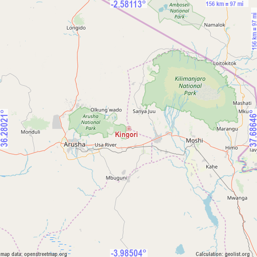
Kingori GPS coordinates[2]
3° 16' 59.988" South, 36° 58' 59.988" East
| Map corner | latitude | longitude |
|---|---|---|
| Upper-left | -2.58113°, | 36.28021° |
| Center: | -3.28333°, | 36.98333° |
| Lower-right: | -3.98504°, | 37.68646° |
| Map W x H: | 156.1×156.1 km | = 97×97mi |
| max Lat: | -1.14389° ⇑19.2% North |
| Kingori: | -3.28333° |
| min Lat: | ⇓80.8% South -11.36667° |
| min Long | Kingori | max Long |
| 29.62667° | 36.98333° | 40.33333° |
| W 66.4%⇐ | ⇒33.6% E |
Elevation
Elevation of Kingori is 1165 m = 3822 ft, and this is 222.2 m = 729 ft above average elevation for this country.
| Max E: |
2377 m = 7799 ft | 43.7% |
| Kingori | 1165 m 3822 ft | |
| Avg. | 942.8 m = 3093 ft | |
Min E: |
0 m = 0 ft | 56.3% |
See also: Tanzania elevation on elevation.city.
Geographical zone
Kingori is located in South Torrid zone (between Equator and Tropic of Capricorn). Distance of Equator is 365.1 km =226.9 mi to North.| Distance of | km | miles | from Kingori |
|---|---|---|---|
| Equator | 365.1 | 226.9 | to North |
| Tropic Capricorn | 2240.8 | 1392.4 | to South |
| Antarctic Circle | 7036.1 | 4372 | to South |
| South Pole | 9642 | 5991.3 | to South |


Nearby cities:
15 places around Kingori: (largest is in red/bold)
• Arusha
34.6 km =21.5 mi,  254°
254°
• Kirya
89.7 km =55.7 mi,  141°
141°
• Kwakoa
97.5 km =60.6 mi,  123°
123°
• Lembeni
89.6 km =55.7 mi,  128°
128°
• Longido
68.9 km =42.8 mi,  332°
332°
• Mbuguni
31.7 km =19.7 mi,  186°
186°
• Merelani
31 km =19.3 mi,  180°
180°
• Monduli
59.2 km =36.8 mi,  268°
268°
• Moshi
39.6 km =24.6 mi,  100°
100°
• Naberera
102.1 km =63.4 mi, 183°
• Namanga
84.4 km =52.4 mi,  344°
344°
• Nkoaranga
21.1 km =13.1 mi, 254°
• Poli
21.1 km =13.1 mi, 254°
• Same
120.5 km =74.9 mi, 136°
• Usa River
17.5 km =10.9 mi,  237°
237°
Sources, notices
• [Note1] Compared only with cities in Tanzania existing in our database
• [Src1] Map data: © OpenStreetMap contributors (CC-BY-SA)
• [Src2] Other city data from geonames.org with taken over terms of usage.
• [Src3] Geographical zone / Annual Mean Temperature by Robert A. Rohde @ Wikipedia
