Arkadyevka geodata
Arkadyevka (Republic of Crimea) is a populated place; located in Ukraine in Europe/Simferopol (GMT+3) time zone. With population of 512 people, there are 1646 cities with bigger population in this country. Compared to other cities in Ukraine, 90.3% of cities are located further ↑North; 60.2% of cities are located further ←West and 54.5% of cities have higher elevation than Arkadyevka. Note1
Administrative division(s):
- Level 1: Republic of Crimea
- Level 2: Simferopol Raion
- Level 3: Rodnikovskoye sel'skoye poselenye


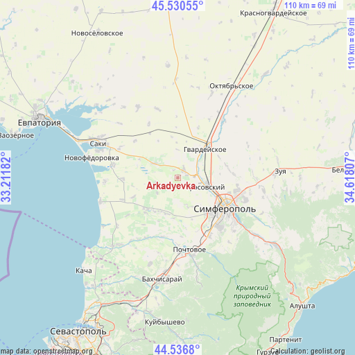
Arkadyevka GPS coordinates[2]
45° 2' 8.988" North, 33° 54' 53.784" East
| Map corner | latitude | longitude |
|---|---|---|
| Upper-left | 45.53055°, | 33.21182° |
| Center: | 45.03583°, | 33.91494° |
| Lower-right: | 44.5368°, | 34.61807° |
| Map W x H: | 110.5×110.5 km | = 68.7×68.7mi |
| max Lat: | 52.18903° ⇑90.3% North |
| Arkadyevka: | 45.03583° |
| min Lat: | ⇓9.7% South 44.39214° |
| min Long | Arkadyevka | max Long |
| 22.20555° | 33.91494° | 40.13222° |
| W 60.2%⇐ | ⇒39.8% E |
Elevation
Elevation of Arkadyevka is 121 m = 397 ft, and this is 34.8 m = 114 ft below average elevation for this country.
| Max E: |
886 m = 2907 ft | 54.5% |
| Avg. | 155.8 m = 511 ft | |
| Arkadyevka | 121 m = 397 ft | |
Min E: |
-3 m = -10 ft | 45.5% |
See also: Ukraine elevation on elevation.city.
Geographical zone
Arkadyevka is located in North temperate zone (between Tropic of Cancer and the Arctic Circle). Distance of this North polar circle is 2393.7 km =1487.4 mi to North.| Distance of | km | miles | from Arkadyevka |
|---|---|---|---|
| North Pole | 4999.5 | 3106.5 | to North |
| Arctic Circle | 2393.7 | 1487.4 | to North |
| Tropic Cancer | 2401.6 | 1492.3 | to South |
| Equator | 5007.5 | 3111.5 | to South |


Nearby cities:
15 places around Arkadyevka: (largest is in red/bold)
• Aeroflotskiy
6.9 km =4.3 mi,  106°
106°
• Agrarnoye
11.4 km =7.1 mi,  101°
101°
• Beloglinka
11 km =6.8 mi, 114°
• Gresovskiy
9.3 km =5.8 mi, 109°
• Kolodeznoye
6.7 km =4.2 mi,  256°
256°
• Komsomol’skoye
9.3 km =5.8 mi, 101°
• Kurgannoye
4.1 km =2.5 mi,  27°
27°
• Malen’koye
8 km =5 mi,  56°
56°
• Novosyolovka
7.8 km =4.8 mi,  233°
233°
• Rodnikovo
3.2 km =2 mi,  75°
75°
• Shkol’noye
2.8 km =1.7 mi,  330°
330°
• Skvortsovo
8.6 km =5.3 mi,  300°
300°
• Sofiivka
8.9 km =5.5 mi,  47°
47°
• Sovkhoznoye
7.5 km =4.7 mi,  94°
94°
• Ukromnoye
7 km =4.3 mi, 83°
Sources, notices
• [Note1] Compared only with cities in Ukraine existing in our database
• [Src1] Map data: © OpenStreetMap contributors (CC-BY-SA)
• [Src2] Other city data from geonames.org with taken over terms of usage.
• [Src3] Geographical zone / Annual Mean Temperature by Robert A. Rohde @ Wikipedia
