Staryy Dobrotvir geodata
Staryy Dobrotvir (Lviv) is a populated place; located in Ukraine in Europe/Kiev (GMT+3) time zone. With population of 6,436 people, there are 542 cities with bigger population in this country. Compared to other cities in Ukraine, 87% of cities are located further ↓South; 90.1% of cities are located further →East and 68.9% of cities have lower elevation than Staryy Dobrotvir. Note1


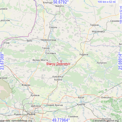
Staryy Dobrotvir GPS coordinates[2]
50° 13' 53.544" North, 24° 22' 37.236" East
| Map corner | latitude | longitude |
|---|---|---|
| Upper-left | 50.6792°, | 23.67389° |
| Center: | 50.23154°, | 24.37701° |
| Lower-right: | 49.77964°, | 25.08014° |
| Map W x H: | 100×100 km | = 62.1×62.1mi |
| max Lat: | 52.18903° ⇑13% North |
| Staryy Dobrotvir: | 50.23154° |
| min Lat: | ⇓87% South 44.39214° |
| min Long | Staryy Dobrotvi | max Long |
| 22.20555° | 24.37701° | 40.13222° |
| W 9.9%⇐ | ⇒90.1% E |
Elevation
Elevation of Staryy Dobrotvir is 201 m = 659 ft, and this is 45.2 m = 148 ft above average elevation for this country.
| Max E: |
886 m = 2907 ft | 31.1% |
| Staryy Dobrotvir | 201 m 659 ft | |
| Avg. | 155.8 m = 511 ft | |
Min E: |
-3 m = -10 ft | 68.9% |
See also: Ukraine elevation on elevation.city.
Geographical zone
Staryy Dobrotvir is located in North temperate zone (between Tropic of Cancer and the Arctic Circle). Distance of this North polar circle is 1816 km =1128.4 mi to North.| Distance of | km | miles | from Staryy Dobrotvir |
|---|---|---|---|
| North Pole | 4421.8 | 2747.6 | to North |
| Arctic Circle | 1816 | 1128.4 | to North |
| Tropic Cancer | 2979.3 | 1851.3 | to South |
| Equator | 5585.2 | 3470.5 | to South |


Nearby cities:
15 places around Staryy Dobrotvir: (largest is in red/bold)
• Belz
31.2 km =19.4 mi,  302°
302°
• Bus’k
34 km =21.1 mi,  150°
150°
• Chervonohrad
20.4 km =12.7 mi,  330°
330°
• Hlyns'k
39 km =24.2 mi,  240°
240°
• Kamianka-Buzka
14.1 km =8.8 mi,  189°
189°
• Krasne
39.1 km =24.3 mi, 154°
• Kulykiv
32.6 km =20.3 mi,  73°
73°
• Kulykiv
35.2 km =21.9 mi,  217°
217°
• Lopatyn
33.5 km =20.8 mi,  92°
92°
• Novyi Yarychiv
36.7 km =22.8 mi, 188°
• Radekhiv
19.7 km =12.2 mi, 73°
• Silets’
14.3 km =8.9 mi, 300°
• Sokal’
27.8 km =17.3 mi,  346°
346°
• Varyazh
37.4 km =23.2 mi, 327°
• Zhovkva
34.7 km =21.6 mi, 236°
Sources, notices
• [Note1] Compared only with cities in Ukraine existing in our database
• [Src1] Map data: © OpenStreetMap contributors (CC-BY-SA)
• [Src2] Other city data from geonames.org with taken over terms of usage.
• [Src3] Geographical zone / Annual Mean Temperature by Robert A. Rohde @ Wikipedia
