Blahodatne geodata
Blahodatne (Volyn) is a populated place; located in Ukraine in Europe/Kiev (GMT+3) time zone. With population of 4,652 people, there are 683 cities with bigger population in this country. Compared to other cities in Ukraine, 93.2% of cities are located further ↓South; 91.2% of cities are located further →East and 72.2% of cities have lower elevation than Blahodatne. Note1


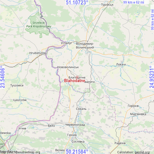
Blahodatne GPS coordinates[2]
50° 39' 49.14" North, 24° 14' 57.048" East
| Map corner | latitude | longitude |
|---|---|---|
| Upper-left | 51.10723°, | 23.54606° |
| Center: | 50.66365°, | 24.24918° |
| Lower-right: | 50.21584°, | 24.95231° |
| Map W x H: | 99.1×99.1 km | = 61.6×61.6mi |
| max Lat: | 52.18903° ⇑6.8% North |
| Blahodatne: | 50.66365° |
| min Lat: | ⇓93.2% South 44.39214° |
| min Long | Blahodatne | max Long |
| 22.20555° | 24.24918° | 40.13222° |
| W 8.8%⇐ | ⇒91.2% E |
Elevation
Elevation of Blahodatne is 214 m = 702 ft, and this is 58.2 m = 191 ft above average elevation for this country.
| Max E: |
886 m = 2907 ft | 27.8% |
| Blahodatne | 214 m 702 ft | |
| Avg. | 155.8 m = 511 ft | |
Min E: |
-3 m = -10 ft | 72.2% |
See also: Ukraine elevation on elevation.city.
Geographical zone
Blahodatne is located in North temperate zone (between Tropic of Cancer and the Arctic Circle). Distance of this North polar circle is 1767.9 km =1098.5 mi to North.| Distance of | km | miles | from Blahodatne |
|---|---|---|---|
| North Pole | 4373.8 | 2717.8 | to North |
| Arctic Circle | 1767.9 | 1098.5 | to North |
| Tropic Cancer | 3027.4 | 1881.1 | to South |
| Equator | 5633.3 | 3500.4 | to South |


Nearby cities:
15 places around Blahodatne: (largest is in red/bold)
• Belz
35.7 km =22.2 mi,  208°
208°
• Chervonohrad
30.3 km =18.8 mi,  181°
181°
• Horokhiv
40.4 km =25.1 mi,  116°
116°
• Ivanychi
8.3 km =5.2 mi,  109°
109°
• Lokachi
29.3 km =18.2 mi,  73°
73°
• Novovolyns’k
9.2 km =5.7 mi,  318°
318°
• Oles’k
49.9 km =31 mi,  355°
355°
• Radekhiv
50.7 km =31.5 mi,  146°
146°
• Silets’
40.9 km =25.4 mi, 184°
• Sokal’
21.2 km =13.2 mi,  173°
173°
• Staryy Dobrotvir
48.9 km =30.4 mi, 169°
• Turiys’k
50.8 km =31.6 mi,  22°
22°
• Uhniv
48.3 km =30 mi,  227°
227°
• Varyazh
19.9 km =12.4 mi, 213°
• Volodymyr-Volynskyi
21.6 km =13.4 mi,  14°
14°
Sources, notices
• [Note1] Compared only with cities in Ukraine existing in our database
• [Src1] Map data: © OpenStreetMap contributors (CC-BY-SA)
• [Src2] Other city data from geonames.org with taken over terms of usage.
• [Src3] Geographical zone / Annual Mean Temperature by Robert A. Rohde @ Wikipedia
