Zelyonoye geodata
Zelyonoye (Republic of Crimea) is a seat of a third-order administrative division; located in Ukraine in Europe/Simferopol (GMT+3) time zone. With population of 280 people, there are 1660 cities with bigger population in this country. Compared to other cities in Ukraine, 97.9% of cities are located further ↑North; 62.9% of cities are located further ←West and 88.4% of cities have lower elevation than Zelyonoye. Note1
Administrative division(s):
- Level 1: Republic of Crimea
- Level 2: Bakhchysarai Raion
- Level 3: Zelenovskoye sel'skoye poselenye


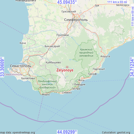
Zelyonoye GPS coordinates[2]
44° 35' 44.988" North, 34° 0' 33.156" East
| Map corner | latitude | longitude |
|---|---|---|
| Upper-left | 45.09435°, | 33.30609° |
| Center: | 44.59583°, | 34.00921° |
| Lower-right: | 44.09299°, | 34.71234° |
| Map W x H: | 111.3×111.3 km | = 69.2×69.2mi |
| max Lat: | 52.18903° ⇑97.9% North |
| Zelyonoye: | 44.59583° |
| min Lat: | ⇓2.1% South 44.39214° |
| min Long | Zelyonoye | max Long |
| 22.20555° | 34.00921° | 40.13222° |
| W 62.9%⇐ | ⇒37.1% E |
Elevation
Elevation of Zelyonoye is 297 m = 974 ft, and this is 141.2 m = 463 ft above average elevation for this country.
| Max E: |
886 m = 2907 ft | 11.6% |
| Zelyonoye | 297 m 974 ft | |
| Avg. | 155.8 m = 511 ft | |
Min E: |
-3 m = -10 ft | 88.4% |
See also: Ukraine elevation on elevation.city.
Geographical zone
Zelyonoye is located in North temperate zone (between Tropic of Cancer and the Arctic Circle). Distance of this Northern Tropic circle is 2352.7 km =1461.9 mi to South.| Distance of | km | miles | from Zelyonoye |
|---|---|---|---|
| North Pole | 5048.5 | 3137 | to North |
| Arctic Circle | 2442.6 | 1517.8 | to North |
| Tropic Cancer | 2352.7 | 1461.9 | to South |
| Equator | 4958.6 | 3081.1 | to South |


Nearby cities:
15 places around Zelyonoye: (largest is in red/bold)
• Golubinka
7.4 km =4.6 mi,  268°
268°
• Kuibyshevo
11.7 km =7.3 mi,  288°
288°
• Livadia
17.5 km =10.9 mi,  142°
142°
• Massandra
17.1 km =10.6 mi,  124°
124°
• Nauchny
14.5 km =9 mi,  0°
0°
• Peredovoye
17.2 km =10.7 mi,  236°
236°
• Plotinnoye
3.6 km =2.2 mi,  253°
253°
• Predushchel’noye
16.5 km =10.3 mi,  318°
318°
• Prokhladnoye
17.9 km =11.1 mi,  355°
355°
• Sokolinoye
6.4 km =4 mi,  218°
218°
• Sovetskoye
15.7 km =9.8 mi, 115°
• Tankovoye
17.3 km =10.7 mi, 293°
• Verkhorechye
11.4 km =7.1 mi,  351°
351°
• Vinogradnoye
15.9 km =9.9 mi, 143°
• Yalta
16.2 km =10.1 mi,  129°
129°
Sources, notices
• [Note1] Compared only with cities in Ukraine existing in our database
• [Src1] Map data: © OpenStreetMap contributors (CC-BY-SA)
• [Src2] Other city data from geonames.org with taken over terms of usage.
• [Src3] Geographical zone / Annual Mean Temperature by Robert A. Rohde @ Wikipedia
