Peredovoye geodata
Peredovoye (Sevastopol City) is a populated place; located in Ukraine in Europe/Simferopol (GMT+3) time zone. With population of 643 people, there are 1556 cities with bigger population in this country. Compared to other cities in Ukraine, 99% of cities are located further ↑North; 58.5% of cities are located further ←West and 93.1% of cities have lower elevation than Peredovoye. Note1
Administrative division(s):
- Level 1: Sevastopol City
- Level 2: Balaklava District
- Level 3: Orlinovskiy munitsipal'niy okrug


Peredovoye GPS coordinates[2]
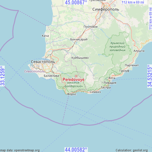
44° 30' 33.84" North, 33° 49' 44.472" East
| Map corner | latitude | longitude |
|---|---|---|
| Upper-left | 45.00867°, | 33.1259° |
| Center: | 44.5094°, | 33.82902° |
| Lower-right: | 44.00582°, | 34.53215° |
| Map W x H: | 111.5×111.5 km | = 69.3×69.3mi |
| max Lat: | 52.18903° ⇑99% North |
| Peredovoye: | 44.5094° |
| min Lat: | ⇓1% South 44.39214° |
| min Long | Peredovoye | max Long |
| 22.20555° | 33.82902° | 40.13222° |
| W 58.5%⇐ | ⇒41.5% E |
Elevation
Elevation of Peredovoye is 333 m = 1093 ft, and this is 177.2 m = 581 ft above average elevation for this country.
| Max E: |
886 m = 2907 ft | 6.9% |
| Peredovoye | 333 m 1093 ft | |
| Avg. | 155.8 m = 511 ft | |
Min E: |
-3 m = -10 ft | 93.1% |
See also: Ukraine elevation on elevation.city.
Geographical zone
Peredovoye is located in North temperate zone (between Tropic of Cancer and the Arctic Circle). Distance of this Northern Tropic circle is 2343.1 km =1455.9 mi to South.| Distance of | km | miles | from Peredovoye |
|---|---|---|---|
| North Pole | 5058.1 | 3143 | to North |
| Arctic Circle | 2452.2 | 1523.7 | to North |
| Tropic Cancer | 2343.1 | 1455.9 | to South |
| Equator | 4949 | 3075.2 | to South |


Nearby cities:
15 places around Peredovoye: (largest is in red/bold)
• Foros
13.4 km =8.3 mi,  194°
194°
• Golubinka
11.6 km =7.2 mi,  36°
36°
• Goluboy Zaliv
16.6 km =10.3 mi,  131°
131°
• Goncharnoye
11.3 km =7 mi,  244°
244°
• Khmel’nitskoye
14.4 km =8.9 mi,  285°
285°
• Krasnyi Mak
15.2 km =9.4 mi,  345°
345°
• Kuibyshevo
13.7 km =8.5 mi,  13°
13°
• Orlinoye
8.1 km =5 mi,  211°
211°
• Plotinnoye
13.8 km =8.6 mi,  51°
51°
• Rodnikovoye
5.3 km =3.3 mi,  160°
160°
• Rodnoye
8.7 km =5.4 mi,  304°
304°
• Shirokoye
5.8 km =3.6 mi, 235°
• Sokolinoye
11.3 km =7 mi,  66°
66°
• Ternovka
9.9 km =6.2 mi,  321°
321°
• Tylovoye
10.8 km =6.7 mi,  225°
225°
Sources, notices
• [Note1] Compared only with cities in Ukraine existing in our database
• [Src1] Map data: © OpenStreetMap contributors (CC-BY-SA)
• [Src2] Other city data from geonames.org with taken over terms of usage.
• [Src3] Geographical zone / Annual Mean Temperature by Robert A. Rohde @ Wikipedia
