Vashkivtsi geodata
Vashkivtsi (Chernivtsi Oblast') is a populated place; located in Ukraine in Europe/Kiev (GMT+3) time zone. With population of 5,764 people, there are 581 cities with bigger population in this country. Compared to other cities in Ukraine, 52.3% of cities are located further ↓South; 83.7% of cities are located further →East and 71.2% of cities have lower elevation than Vashkivtsi. Note1


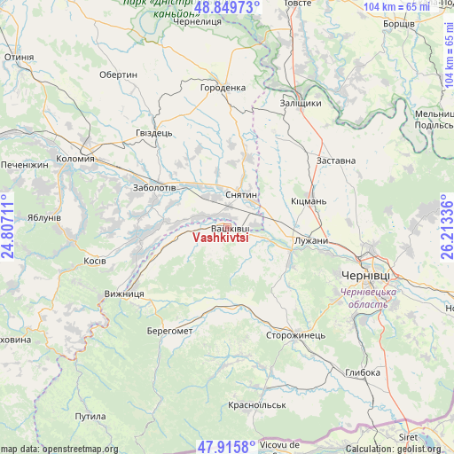
Vashkivtsi GPS coordinates[2]
48° 23' 5.676" North, 25° 30' 36.828" East
| Map corner | latitude | longitude |
|---|---|---|
| Upper-left | 48.84973°, | 24.80711° |
| Center: | 48.38491°, | 25.51023° |
| Lower-right: | 47.9158°, | 26.21336° |
| Map W x H: | 103.8×103.8 km | = 64.5×64.5mi |
| max Lat: | 52.18903° ⇑47.7% North |
| Vashkivtsi: | 48.38491° |
| min Lat: | ⇓52.3% South 44.39214° |
| min Long | Vashkivtsi | max Long |
| 22.20555° | 25.51023° | 40.13222° |
| W 16.3%⇐ | ⇒83.7% E |
Elevation
Elevation of Vashkivtsi is 211 m = 692 ft, and this is 55.2 m = 181 ft above average elevation for this country.
| Max E: |
886 m = 2907 ft | 28.8% |
| Vashkivtsi | 211 m 692 ft | |
| Avg. | 155.8 m = 511 ft | |
Min E: |
-3 m = -10 ft | 71.2% |
See also: Ukraine elevation on elevation.city.
Geographical zone
Vashkivtsi is located in North temperate zone (between Tropic of Cancer and the Arctic Circle). Distance of this North polar circle is 2021.3 km =1256 mi to North.| Distance of | km | miles | from Vashkivtsi |
|---|---|---|---|
| North Pole | 4627.2 | 2875.2 | to North |
| Arctic Circle | 2021.3 | 1256 | to North |
| Tropic Cancer | 2774 | 1723.7 | to South |
| Equator | 5379.9 | 3342.9 | to South |


Nearby cities:
15 places around Vashkivtsi: (largest is in red/bold)
• Banyliv
12.3 km =7.6 mi,  260°
260°
• Berehomet
25.8 km =16 mi,  207°
207°
• Ispas
20 km =12.4 mi,  240°
240°
• Khymchyn
26.7 km =16.6 mi,  270°
270°
• Kitsman’
20 km =12.4 mi,  70°
70°
• Luzhany
19.4 km =12.1 mi,  96°
96°
• Myhove
27.1 km =16.8 mi,  201°
201°
• Rozhniv
21.1 km =13.1 mi, 264°
• Shypyntsi
17.5 km =10.9 mi,  92°
92°
• Sniatyn
8.2 km =5.1 mi,  32°
32°
• Stari Kuty
28 km =17.4 mi, 243°
• Stetseva
16.6 km =10.3 mi,  16°
16°
• Verenchanka
25 km =15.5 mi,  43°
43°
• Vyzhnytsya
27.9 km =17.3 mi, 236°
• Zabolotiv
19.1 km =11.9 mi,  299°
299°
Sources, notices
• [Note1] Compared only with cities in Ukraine existing in our database
• [Src1] Map data: © OpenStreetMap contributors (CC-BY-SA)
• [Src2] Other city data from geonames.org with taken over terms of usage.
• [Src3] Geographical zone / Annual Mean Temperature by Robert A. Rohde @ Wikipedia
