Stetseva geodata
Stetseva (Ivano-Frankivsk) is a populated place; located in Ukraine in Europe/Kiev (GMT+3) time zone. With population of 3,076 people, there are 917 cities with bigger population in this country. Compared to other cities in Ukraine, 56% of cities are located further ↓South; 83.3% of cities are located further →East and 80.4% of cities have lower elevation than Stetseva. Note1


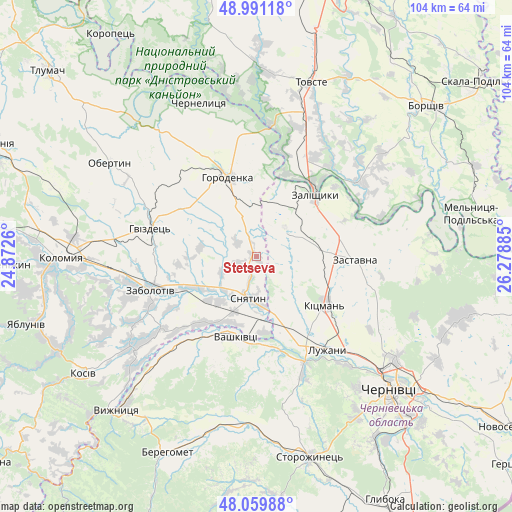
Stetseva GPS coordinates[2]
48° 31' 39.612" North, 25° 34' 32.592" East
| Map corner | latitude | longitude |
|---|---|---|
| Upper-left | 48.99118°, | 24.8726° |
| Center: | 48.52767°, | 25.57572° |
| Lower-right: | 48.05988°, | 26.27885° |
| Map W x H: | 103.6×103.5 km | = 64.4×64.3mi |
| max Lat: | 52.18903° ⇑44% North |
| Stetseva: | 48.52767° |
| min Lat: | ⇓56% South 44.39214° |
| min Long | Stetseva | max Long |
| 22.20555° | 25.57572° | 40.13222° |
| W 16.7%⇐ | ⇒83.3% E |
Elevation
Elevation of Stetseva is 249 m = 817 ft, and this is 93.2 m = 306 ft above average elevation for this country.
| Max E: |
886 m = 2907 ft | 19.6% |
| Stetseva | 249 m 817 ft | |
| Avg. | 155.8 m = 511 ft | |
Min E: |
-3 m = -10 ft | 80.4% |
See also: Ukraine elevation on elevation.city.
Geographical zone
Stetseva is located in North temperate zone (between Tropic of Cancer and the Arctic Circle). Distance of this North polar circle is 2005.4 km =1246.1 mi to North.| Distance of | km | miles | from Stetseva |
|---|---|---|---|
| North Pole | 4611.3 | 2865.3 | to North |
| Arctic Circle | 2005.4 | 1246.1 | to North |
| Tropic Cancer | 2789.9 | 1733.6 | to South |
| Equator | 5395.8 | 3352.8 | to South |


Nearby cities:
15 places around Stetseva: (largest is in red/bold)
• Banyliv
24.7 km =15.3 mi,  223°
223°
• Chernyatyn
17.5 km =10.9 mi,  327°
327°
• Horodenka
17 km =10.6 mi,  341°
341°
• Kadubivtsi
15.5 km =9.6 mi,  66°
66°
• Kitsman’
16.9 km =10.5 mi,  123°
123°
• Kostryzhivka
17.4 km =10.8 mi,  35°
35°
• Luzhany
23.2 km =14.4 mi,  141°
141°
• Rozhniv
31.5 km =19.6 mi,  235°
235°
• Shypyntsi
21 km =13 mi, 143°
• Sniatyn
9 km =5.6 mi,  182°
182°
• Vashkivtsi
16.6 km =10.3 mi,  196°
196°
• Verenchanka
12.7 km =7.9 mi,  80°
80°
• Zabolotiv
22.3 km =13.9 mi,  253°
253°
• Zalishchyky
17.5 km =10.9 mi, 42°
• Zastavna
19.7 km =12.2 mi,  91°
91°
Sources, notices
• [Note1] Compared only with cities in Ukraine existing in our database
• [Src1] Map data: © OpenStreetMap contributors (CC-BY-SA)
• [Src2] Other city data from geonames.org with taken over terms of usage.
• [Src3] Geographical zone / Annual Mean Temperature by Robert A. Rohde @ Wikipedia
