Zabolotiv geodata
Zabolotiv (Ivano-Frankivsk) is a populated place; located in Ukraine in Europe/Kiev (GMT+3) time zone. With population of 4,029 people, there are 758 cities with bigger population in this country. Compared to other cities in Ukraine, 54.7% of cities are located further ↓South; 84.7% of cities are located further →East and 76.8% of cities have lower elevation than Zabolotiv. Note1


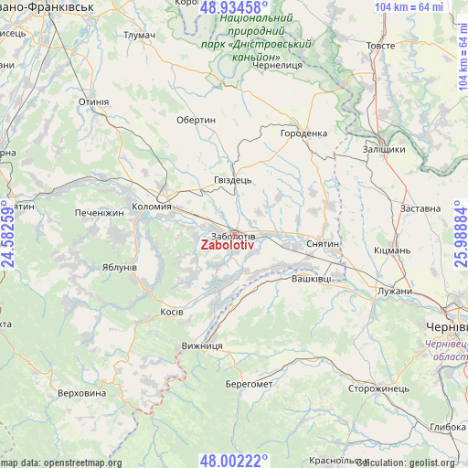
Zabolotiv GPS coordinates[2]
48° 28' 13.944" North, 25° 17' 8.556" East
| Map corner | latitude | longitude |
|---|---|---|
| Upper-left | 48.93458°, | 24.58259° |
| Center: | 48.47054°, | 25.28571° |
| Lower-right: | 48.00222°, | 25.98884° |
| Map W x H: | 103.7×103.7 km | = 64.4×64.4mi |
| max Lat: | 52.18903° ⇑45.3% North |
| Zabolotiv: | 48.47054° |
| min Lat: | ⇓54.7% South 44.39214° |
| min Long | Zabolotiv | max Long |
| 22.20555° | 25.28571° | 40.13222° |
| W 15.3%⇐ | ⇒84.7% E |
Elevation
Elevation of Zabolotiv is 233 m = 764 ft, and this is 77.2 m = 253 ft above average elevation for this country.
| Max E: |
886 m = 2907 ft | 23.2% |
| Zabolotiv | 233 m 764 ft | |
| Avg. | 155.8 m = 511 ft | |
Min E: |
-3 m = -10 ft | 76.8% |
See also: Ukraine elevation on elevation.city.
Geographical zone
Zabolotiv is located in North temperate zone (between Tropic of Cancer and the Arctic Circle). Distance of this North polar circle is 2011.8 km =1250.1 mi to North.| Distance of | km | miles | from Zabolotiv |
|---|---|---|---|
| North Pole | 4617.6 | 2869.2 | to North |
| Arctic Circle | 2011.8 | 1250.1 | to North |
| Tropic Cancer | 2783.5 | 1729.6 | to South |
| Equator | 5389.4 | 3348.8 | to South |


Nearby cities:
15 places around Zabolotiv: (largest is in red/bold)
• Banyliv
12.4 km =7.7 mi,  159°
159°
• Chernyatyn
24.3 km =15.1 mi,  29°
29°
• Ispas
19.3 km =12 mi,  182°
182°
• Khymchyn
13.8 km =8.6 mi,  227°
227°
• Kolomyia
19.6 km =12.2 mi,  290°
290°
• Kosiv
22.6 km =14 mi,  218°
218°
• Kuty
24.8 km =15.4 mi,  198°
198°
• Rozhniv
12.4 km =7.7 mi, 200°
• Sniatyn
21.1 km =13.1 mi,  97°
97°
• Stari Kuty
23.7 km =14.7 mi, 200°
• Stetseva
22.3 km =13.9 mi,  73°
73°
• Vashkivtsi
19.1 km =11.9 mi,  119°
119°
• Velykyy Klyuchiv
25 km =15.5 mi,  270°
270°
• Vyzhnytsya
25.6 km =15.9 mi, 195°
• Yabluniv
26.6 km =16.5 mi,  253°
253°
Sources, notices
• [Note1] Compared only with cities in Ukraine existing in our database
• [Src1] Map data: © OpenStreetMap contributors (CC-BY-SA)
• [Src2] Other city data from geonames.org with taken over terms of usage.
• [Src3] Geographical zone / Annual Mean Temperature by Robert A. Rohde @ Wikipedia
