Myhove geodata
Myhove (Chernivtsi Oblast') is a populated place; located in Ukraine in Europe/Kiev (GMT+3) time zone. With population of 3,546 people, there are 824 cities with bigger population in this country. Compared to other cities in Ukraine, 53.2% of cities are located further ↑North; 84.2% of cities are located further →East and 97.5% of cities have lower elevation than Myhove. Note1


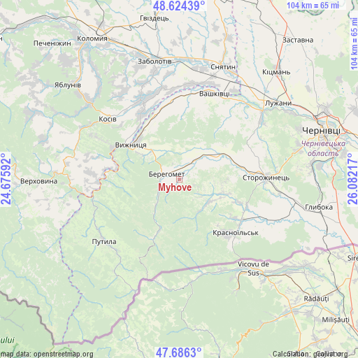
Myhove GPS coordinates[2]
48° 9' 26.964" North, 25° 22' 44.544" East
| Map corner | latitude | longitude |
|---|---|---|
| Upper-left | 48.62439°, | 24.67592° |
| Center: | 48.15749°, | 25.37904° |
| Lower-right: | 47.6863°, | 26.08217° |
| Map W x H: | 104.3×104.3 km | = 64.8×64.8mi |
| max Lat: | 52.18903° ⇑53.2% North |
| Myhove: | 48.15749° |
| min Lat: | ⇓46.8% South 44.39214° |
| min Long | Myhove | max Long |
| 22.20555° | 25.37904° | 40.13222° |
| W 15.8%⇐ | ⇒84.2% E |
Elevation
Elevation of Myhove is 451 m = 1480 ft, and this is 295.2 m = 969 ft above average elevation for this country.
| Max E: |
886 m = 2907 ft | 2.5% |
| Myhove | 451 m 1480 ft | |
| Avg. | 155.8 m = 511 ft | |
Min E: |
-3 m = -10 ft | 97.5% |
See also: Ukraine elevation on elevation.city.
Geographical zone
Myhove is located in North temperate zone (between Tropic of Cancer and the Arctic Circle). Distance of this North polar circle is 2046.6 km =1271.7 mi to North.| Distance of | km | miles | from Myhove |
|---|---|---|---|
| North Pole | 4652.5 | 2890.9 | to North |
| Arctic Circle | 2046.6 | 1271.7 | to North |
| Tropic Cancer | 2748.7 | 1708 | to South |
| Equator | 5354.6 | 3327.2 | to South |


Nearby cities:
15 places around Myhove: (largest is in red/bold)
• Banyliv
23.3 km =14.5 mi,  353°
353°
• Berehomet
3.3 km =2.1 mi,  316°
316°
• Chudey
21.5 km =13.4 mi,  122°
122°
• Davydivka
14.4 km =8.9 mi,  106°
106°
• Ispas
17.4 km =10.8 mi,  333°
333°
• Kosiv
27 km =16.8 mi,  309°
309°
• Kuty
18.6 km =11.6 mi, 307°
• Nyzhni Petrivtsi
29.3 km =18.2 mi, 119°
• Putyla
28.3 km =17.6 mi,  228°
228°
• Rozhniv
25.8 km =16 mi, 333°
• Stari Kuty
19.8 km =12.3 mi, 309°
• Storozhynets’
25.3 km =15.7 mi,  88°
88°
• Vashkivtsi
27.1 km =16.8 mi,  21°
21°
• Vyzhnytsya
17 km =10.6 mi, 306°
• Yizhivtsi
24.8 km =15.4 mi, 121°
Sources, notices
• [Note1] Compared only with cities in Ukraine existing in our database
• [Src1] Map data: © OpenStreetMap contributors (CC-BY-SA)
• [Src2] Other city data from geonames.org with taken over terms of usage.
• [Src3] Geographical zone / Annual Mean Temperature by Robert A. Rohde @ Wikipedia
