Shypyntsi geodata
Shypyntsi (Chernivtsi Oblast') is a populated place; located in Ukraine in Europe/Kiev (GMT+3) time zone. With population of 2,937 people, there are 964 cities with bigger population in this country. Compared to other cities in Ukraine, 52% of cities are located further ↓South; 82.2% of cities are located further →East and 63.8% of cities have lower elevation than Shypyntsi. Note1


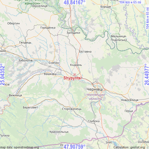
Shypyntsi GPS coordinates[2]
48° 22' 36.372" North, 25° 44' 47.904" East
| Map corner | latitude | longitude |
|---|---|---|
| Upper-left | 48.84167°, | 25.04352° |
| Center: | 48.37677°, | 25.74664° |
| Lower-right: | 47.90759°, | 26.44977° |
| Map W x H: | 103.9×103.9 km | = 64.6×64.6mi |
| max Lat: | 52.18903° ⇑48% North |
| Shypyntsi: | 48.37677° |
| min Lat: | ⇓52% South 44.39214° |
| min Long | Shypyntsi | max Long |
| 22.20555° | 25.74664° | 40.13222° |
| W 17.8%⇐ | ⇒82.2% E |
Elevation
Elevation of Shypyntsi is 182 m = 597 ft, and this is 26.2 m = 86 ft above average elevation for this country.
| Max E: |
886 m = 2907 ft | 36.2% |
| Shypyntsi | 182 m 597 ft | |
| Avg. | 155.8 m = 511 ft | |
Min E: |
-3 m = -10 ft | 63.8% |
See also: Ukraine elevation on elevation.city.
Geographical zone
Shypyntsi is located in North temperate zone (between Tropic of Cancer and the Arctic Circle). Distance of this North polar circle is 2022.2 km =1256.5 mi to North.| Distance of | km | miles | from Shypyntsi |
|---|---|---|---|
| North Pole | 4628.1 | 2875.8 | to North |
| Arctic Circle | 2022.2 | 1256.5 | to North |
| Tropic Cancer | 2773.1 | 1723.1 | to South |
| Equator | 5379 | 3342.4 | to South |


Nearby cities:
15 places around Shypyntsi: (largest is in red/bold)
• Banyliv
29.7 km =18.5 mi,  267°
267°
• Chernivtsi
17.2 km =10.7 mi,  123°
123°
• Kadubivtsi
23 km =14.3 mi,  4°
4°
• Kitsman’
7.6 km =4.7 mi,  11°
11°
• Luzhany
2.3 km =1.4 mi,  125°
125°
• Molodiya
26.5 km =16.5 mi, 130°
• Ropcha
28.6 km =17.8 mi,  175°
175°
• Sniatyn
15.2 km =9.4 mi,  300°
300°
• Stetseva
21 km =13 mi,  323°
323°
• Storozhynets’
23.7 km =14.7 mi, 184°
• Vashkivtsi
17.5 km =10.9 mi, 272°
• Verenchanka
18.9 km =11.7 mi,  359°
359°
• Voloka
24.6 km =15.3 mi,  146°
146°
• Zalishchyky
29.6 km =18.4 mi, 358°
• Zastavna
17.8 km =11.1 mi,  23°
23°
Sources, notices
• [Note1] Compared only with cities in Ukraine existing in our database
• [Src1] Map data: © OpenStreetMap contributors (CC-BY-SA)
• [Src2] Other city data from geonames.org with taken over terms of usage.
• [Src3] Geographical zone / Annual Mean Temperature by Robert A. Rohde @ Wikipedia
